From now into Sunday morning, there will be sporadic bands of snow moving in from TN, with the much colder air mass moving in. There is no one major event, but any good band of snow can quickly deposit 1/2" or an inch, even 2"...overall there shouldn't be that much snowfall, as the models are running from 2-4" for the next several days.
I'll be back Thursday afternoon, so if anyone has any reports, please add them below in the comments or use the email button and send the info to me and I'll enter it. Thanks in advance for your help.
Bob
Wednesday, February 27, 2013
Tuesday, February 26, 2013
TUESDAY 640am UPDATE
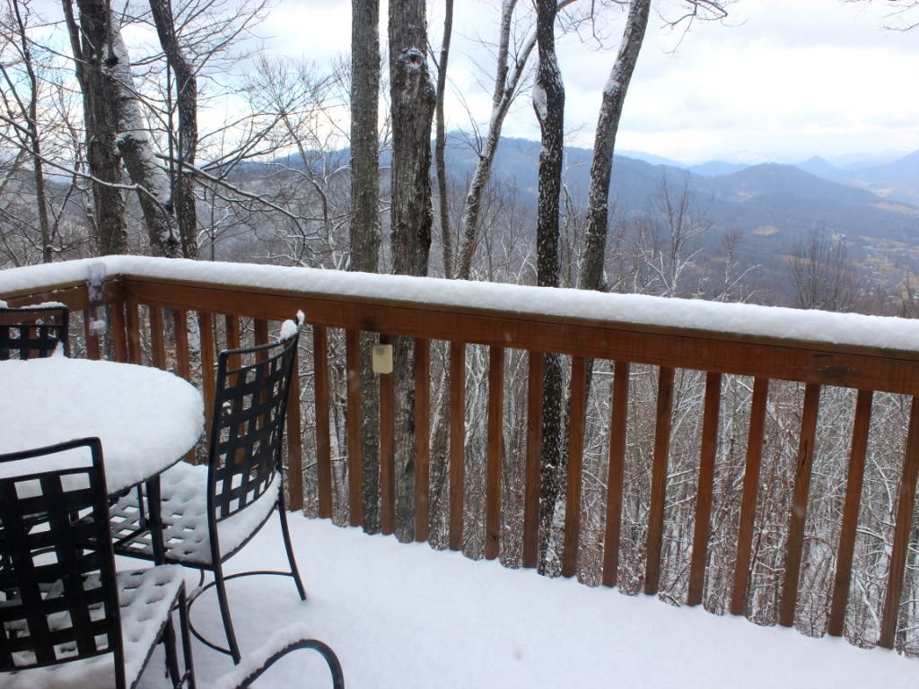
At the top of ACA it's 32 at ground level, and 33 or so on elevated decks, with some icing beginning to take place. While there will be a transition to all rain later this morning, we're clearly riding a tight rail in which travel troubles could escalate...again, nothing to do but wait it out in the temperature department.
The wind fields are not impressive this morning, for our area anyway...I don't see high wind issues today, though it could get windy tomorrow morning as another cold front slams through.
I'm in Charlotte and heading in to my station in momentarily and will update through the morning as I get info.
Per wintry weather for the rest of the week, it's unsettled to say the least, and while the amount of precipitation won't be huge, models still painting 1-3" widespread for ACA over the course of 4 days, with heavier amounts along the TN border...that area will catch the brunt, and ACA will pick up any dregs that make it over those high mountains in an upslope NW flow situation. Our first good chance at some accumulating snow will develop overnight Wednesday into Thursday morning...will update later on that.
As I started saying on-air yesterday, it doesn't matter whether March comes in like a lion or a sheep...both animals will come in wearing polarfleece...
bob
Monday, February 25, 2013
WINTER WEATHER UPDATE
Easier to post something new...several models want to deteriorate our overnight weather in the short term and throw us into the realm of freezing rain, the worst of our wintry scenarios. Couple that with high winds, and we'll be wishing for quiet spring weather!
We are also under a HIGH WIND WARNING above 3500' for winds gusting to or above 50mph in ACA...less speed in our lower half. That lasts from midnight through 6p Tuesday. Power outages are a likely possibility, so keep the flashlights and candles handy.
ACA is in a WINTER WEATHER ADVISORY for freezing rain overnight tonight (9pm) through Tuesday morning (9am), the biggest concern for accumulating ice on all surfaces. It's all about the surface temperature, and I'm not there to watch my thermometer. Please report your temps and conditions in the comment form below, or use the email button to email your info and I'll post it that way.
ACA is still looking at a colder and more wintry precipitation pattern Wednesday through Saturday, Ugh. NAM is running 2-3", but the GFS is still at 1". The GFS has been more accurate so far this season, though the model doesn't see out the full time period at this moment.
bob
WEATHER THIS WEEK
HIGH WIND WARNING above the blue roof house from midnight tonight through 6p Tuesday...and below the blue roof a WIND ADVISORY for the same period. A strong front will move through with a good bit of wind and rain, and the ground is still rather saturated...all that to remind you power outages are possible and to keep your handy dandy flashlights and candles ready just in case. I don't think the top of ACA will catch the 60-65mph winds the highest peaks will have, but I expect ACA trees to be doing the Watusi with gusts in the 35-45mph range.
The end of this week, Wednesday night through Saturday, will be unsettled and colder, with some chances for light snow. The NAM is pushing 2", the GFS just 1"...but this is early in the week for that time frame. I'll update later Tuesday or Wednesday morning with any concerns for ACA.
bob
The end of this week, Wednesday night through Saturday, will be unsettled and colder, with some chances for light snow. The NAM is pushing 2", the GFS just 1"...but this is early in the week for that time frame. I'll update later Tuesday or Wednesday morning with any concerns for ACA.
bob
Thursday, February 21, 2013
FREEZING RAIN ADVISORY overnight
The advisory encompassing ACA is for elevations above 3500', which is the Moskos/blue roof and up. Good amount of rain should start falling before midnight, and sometime before sunrise temps could drop to that magic icing level and create some light icing. All should transition to rain before ending later in the morning...this will be one of those situations where, should icing develop as outlined, there will be nothing to do except let the weather run its course and thaw itself.
bob
bob
Tuesday, February 19, 2013
TUESDAY AM SNOW/UPDATE
(click pics to enlarge)
 |
| Just incredible...watch for reforming ice overnight tonight! |
 |
| 745am |
 |
| 745am |
Feel free to add road conditions, etc. below.
bob
Monday, February 18, 2013
WINTRY MIX OVERNIGHT LIKELY
ACA is now in another Winter Weather Advisory tonight through Tuesday morning, for a wintry mix of sleet and snow, and SHOULD transition to rain sometime after sunrise. The advisory is for 1-2" of 'stuff' tonight, and 1-2" of stuff Tuesday. With sleet and rain mixing in, totals should be held back...I will be more concerned with slippery roads than amounts. A little snow and sleet goes a long way in assisting vehicles into ditches.
Onset is around midnight, with a better burst before and through sunrise in the morning. We are getting above freezing today, and the forecast low is only in the 27-30 range, so not an icebox. I would like to think any morning problems disappear later in the afternoon, unless the accumulations hold true.
The trusty GFS this season has only 1" for ACA, and the NAM is running 1-2", both less than National Weather Service guidance at this time.
bob
Sunday, February 17, 2013
BRRRRRRR!
The above pic (click to enlarge) I took yesterday afternoon...for all of our snow on the N exposure, that's Utah Mountain in the background...higher than ACA, but barely a heavy dusting on their mountaintop meadow, and virtually nothing on the SE facing slopes.
Heavens, those winds have been howling all night and still going strong. Thankfully we've kept power on. Low of 12 last night, now 14 as I type. We got another 1/2" of new and windblown snow up on the upper half of ACA overnight, but down through the trees I do see a darker ribbon that is Apple Creek Road...just not close enough to check its condition. I drove it up around 7p yesterday, and didn't have any troubles, but with these really cold temps, not sure what the condition is this morning.
Once again, the GFS outperformed the NAM models for this storm, and it especially nailed the 2-5" along and east of I-85 in the Piedmont. It did not pick up on the bit heavier mountain snow, which Haywood had some of the higher amounts. CLICK HERE to go to the NWS link showing the totals reported in the NC/SC/GA region.
I already checked the NCDOT traffic management map and all major highways are in great shape this morning...side roads and small highways not so much. When I went into town yesterday evening, it was strange to see the Russ Avenue stretch with not a trace of snow, and over an inch everywhere over by Walmart area. Last night's super cold temps allowed for snow to stick wherever it fell, but it's a shallow layer...and some melting in store Monday.
Road reports/updates can be added below in the comments, or hit the email button and send me info and I'll put it in. Freezing rain in our Tuesday forecast, just FYI...more on that as the time nears.
Bob
Saturday, February 16, 2013
Storm reports and wrap-up
745pm: Easier sometimes to start a new page...there are some good bands of snow showers hitting the Smokies, and ACA is just off the NE end of the Smokies. Certainly a potential for a good dusting overnight, and the snow showers continue to fly right now, though no comparison to this morning's snow. Limited accumulations are likely tonight, but thankfully Apple Creek Road got plowed and salted where serious issues were earlier today, namely the double hairpins on up. Unfortunately, looks like some cars heading to body shop as they had big problems getting up and/or down the upper half of ACA. What snow accumulates tonight should be negotiable with the brine levels on the road...just use extreme caution in the morning.
The other odd thing about this event...NOTHING down at Lake J...Russ Avenue blank...yet at Walmart all was snow-covered nicely. I look across at Utah Mountain which is higher than ACA, but their meadow up top had only a dusting to light accumulations...with almost no snow on the SE facing slopes. Even in ACA there was a huge difference with the 4" at Al Rose's house up top, 3" at mine on Staymon, and minimal stuff down low. Many 6" readings in the higher elevations around Maggie Valley.
Both Al and I separately drove down and back up Apple Creek Road late this afternoon. 4WD will make it, but any 2WD cars and maybe some AWD ones might slip a good bit on the upper reaches of ACA. From the blue roof down there's zero issues. I imagine the untreated side roads are more of a challenge, as Staymon was...but I did some work on it and crawled right up coming home.
Let's put reports here of any problems/observations/etc....and will put any morning updates here. Thanks for everyone's input!
Bob
 |
| 750pm Morristown radar...click to enlarge |
Both Al and I separately drove down and back up Apple Creek Road late this afternoon. 4WD will make it, but any 2WD cars and maybe some AWD ones might slip a good bit on the upper reaches of ACA. From the blue roof down there's zero issues. I imagine the untreated side roads are more of a challenge, as Staymon was...but I did some work on it and crawled right up coming home.
Let's put reports here of any problems/observations/etc....and will put any morning updates here. Thanks for everyone's input!
Bob
Friday, February 15, 2013
Roll The Snow Dice...
Update: 230p 3" at the end of Staymon, 4" at the top of ACA...looking down into the valley. Lake J and surrounding area snowless, even high SE facing mountainsides with minimal snow. Good ol' N exposure! To my understanding plowing and salting has been called in.
Update: 10:45a I second Lynn Damon's comment...I went out to plow the driveway and just on the level part it is extremely slippery under the snow. YakTrax are in order, but snow continues to fly so not worth clearing just now. Simply passing on that there are surely very slick spots on the road. Radar still has some good bands heading in from TN our way, so got a ways to go with all this. 2" and counting at the end of Staymon right now. Please feel free to add any road/travel comments below, or use the email symbol and email me info.

At least we're heading into this with temps well above freezing today. That will change tonight as sharply colder air moves in for the weekend. If we're lucky we MIGHT see 32 degrees Sunday, but most of us will stay below 32 until Monday.
ACA is in a Winter Weather Advisory from 12a tonight through 12p Sunday. Overnight snow chances are not huge (snowing and accumulating at 8:20p, and 22 degrees)...but all day Saturday through midnight we'll have hit and miss bands of snow showers, which as we witnessed in the last snow a couple of Saturdays ago can deposit very quickly if you get one overhead.
The NWS forecast in the advisory is for 2-3" with isolated higher amounts on peaks. Of my two models I follow, the NAM has held 0-1" all along, but the GFS is running a solid 2"...this winter the GFS has outperformed the NAM almost every event here in ACA. The one interesting 'difference' is what will happen along and east of I-85 in SC and up through Charlotte: The NAM has a spotty 0-1" and the GFS has a good 3-5" for Spartanburg through Camden. A chin-stroker for them, no doubt.
By Saturday night, the winds should be cranking, adding to the big chill...and while we've been above freezing today, we should go below 32 by 9 or 10pm, and precipitation is already in the mountains with a good bit banked up in TN (click radar image below to enlarge). Slippery travel is expected. so head's up. You all know the drill.
Bob
Update: 10:45a I second Lynn Damon's comment...I went out to plow the driveway and just on the level part it is extremely slippery under the snow. YakTrax are in order, but snow continues to fly so not worth clearing just now. Simply passing on that there are surely very slick spots on the road. Radar still has some good bands heading in from TN our way, so got a ways to go with all this. 2" and counting at the end of Staymon right now. Please feel free to add any road/travel comments below, or use the email symbol and email me info.

At least we're heading into this with temps well above freezing today. That will change tonight as sharply colder air moves in for the weekend. If we're lucky we MIGHT see 32 degrees Sunday, but most of us will stay below 32 until Monday.
ACA is in a Winter Weather Advisory from 12a tonight through 12p Sunday. Overnight snow chances are not huge (snowing and accumulating at 8:20p, and 22 degrees)...but all day Saturday through midnight we'll have hit and miss bands of snow showers, which as we witnessed in the last snow a couple of Saturdays ago can deposit very quickly if you get one overhead.
The NWS forecast in the advisory is for 2-3" with isolated higher amounts on peaks. Of my two models I follow, the NAM has held 0-1" all along, but the GFS is running a solid 2"...this winter the GFS has outperformed the NAM almost every event here in ACA. The one interesting 'difference' is what will happen along and east of I-85 in SC and up through Charlotte: The NAM has a spotty 0-1" and the GFS has a good 3-5" for Spartanburg through Camden. A chin-stroker for them, no doubt.
By Saturday night, the winds should be cranking, adding to the big chill...and while we've been above freezing today, we should go below 32 by 9 or 10pm, and precipitation is already in the mountains with a good bit banked up in TN (click radar image below to enlarge). Slippery travel is expected. so head's up. You all know the drill.
 |
| Morristown, TN radar ~4pm Friday |
Bob
Wednesday, February 13, 2013
Upcoming Weather

Here is your 50-cent word for the day: Graupel. Late afternoon yesterday, with the air temp at 44 degrees, I had a burst of graupel, itsy bitsy balls of snow. Melted very quickly, that little odd occurrence...but my "odd" record was 3 minutes of sleet with the air temp at 50.4 degrees north of Asheville many moons ago.
Just added these pics taken at 2pm...a valley rainbow running up the Maggie Valley highway (click to enlarge):


Bob
Monday, February 4, 2013
Minor Mixed Precip and Songwriting?
What do the two things in the title have in common? Absolutely nothing...I was just going to make a little mention of a VERY minor weather event, or at least the potential for it...could just as easily not posted anything, until I got Lorraine's email about a free lecture/performance some of you might be interested in. Figured I'd share them both with you.
Per the weather, there is a limited chance for some showers Tuesday morning...and if there were some falling just before daybreak, and the temp is below 32, it could be a brief period of freezing rain. Just an fyi, as temps go above freezing fairly quickly as we're in a nice warming trend for now. Relative to last week, most things would be a warming trend, eh?!
Our current ACA president, Lorraine Conard, is a long-established and accomplished folk/folk blues/folk Americana musician. This Wednesday, February 6, from 7-8pm, she is giving a free lecture/performance about her songwriting at Providence Church on the Haywood Chrisitan Academy Campus...VERY close to ACA, near the Jones Cove recycling facility. More info, directions, etc. can be found at THIS LINK. I'd be there if I weren't out of town already. Should be a worthy gathering!
Bob
Sunday, February 3, 2013
SUNDAY reports
UPDATE @ 3PM: Apple Creek Road has been replowed and (earlier) salted and looks to be in good shape. Keep in mind refreeze will be possible in patches for those heading out early in the morning (which includes myself). The side roads are extremely slick given the silky wet snow...I had a devil of a time negotiating Staymon.
(NOTE: always a good idea to 'refresh' this screen when you view it as I add little things now and then to fine tune) Figured I'd just post this to be a clean place for anyone to add road observations for us. I picked up 1.5" last night, but the wind rearranged some of it. 27 degrees this morning.
I caught a few glimpses of Apple Creek Road earlier, which is not totally white, but surely a mix of snow and ice over what black asphalt I can see...and can only assume it's pretty slick right now. Snow showers hanging over the TN border, moving our way, allowing for more accumulation this morning. Good bit of moisture on the radar in east TN yet to move in, as well, and it's snowing pretty hard as I type at 7:55am. Our Winter Storm Warning goes through noon today.
Quick accumulations in this morning's snow showers...up to 3" in places. Molly and Maisy just love this stuff...clearly, they are not the ones who have to drive in it or shovel it!
bob
 |
| 7:30am Sunday...nice little pink-orange glow for a minute or so |
I caught a few glimpses of Apple Creek Road earlier, which is not totally white, but surely a mix of snow and ice over what black asphalt I can see...and can only assume it's pretty slick right now. Snow showers hanging over the TN border, moving our way, allowing for more accumulation this morning. Good bit of moisture on the radar in east TN yet to move in, as well, and it's snowing pretty hard as I type at 7:55am. Our Winter Storm Warning goes through noon today.
 |
| only 15 minutes later than above as snow showers move in |
 |
| ...and only 5 minutes later than the last shot...snowing nicely now |
bob
Saturday, February 2, 2013
WARNING update
UPDATE @ 7:15p SATURDAY: The NWS has put Haywood County in a Winter Storm Warning for 3-5" of snow and 8" in the highest elevations...I do think the bigger stuff is intended for the Smokies and Plott Balsams, but they're close to here. Radars unimpressive into TN west of I-81, but it is banked up along and over the TN line. Still feeling ACA is in the 2 to maybe 3" range. At least we keep temps within a stone's throw of freezing.
bob
bob
Friday, February 1, 2013
HERE WE GO AGAIN....
UPDATE @ 7:15p SATURDAY: The NWS has put Haywood County in a Winter Storm Warning for 3-5" of snow and 8" in the highest elevations...I do think the bigger stuff is intended for the Smokies and Plott Balsams, but they're close to here. Radars unimpressive into TN west of I-81, but it is banked up along and over the TN line. Still feeling ACA is in the 2 to maybe 3" range.
Third time is the charm? Yet another Winter Weather Advisory is in effect for ACA from noon Saturday through noon Sunday. The going advisory is for 2-5"...yet neither of my models has over 3". The GFS, champion so far this year, says 1-2". The NAM says 2-3". The Smokies stand to get the 4-5" I suppose, and from Sam's Gap north will get a good bit...but neither of these models is hot and heavy this time.
Onset will be in the late afternoon, with a 'likely' period of potential snow from 4p through 9pm, with scattered light snow before and after. The other chin-stroker is the potential for rain to mix in as the temp flirts between 31 and 33 degrees....and the digital output says after midnight the temp will rise to slightly above freezing before dropping again. That would sure make a mess...and maybe the above two models are factoring in the mixed rain which would reduce snow totals some. Hmmmmmm....
Just throwing this out there tonight...I'll update in the morning. If you twisted my arm I'd go with 1.5 to 2" for us...but at least this arctic blast we have now will be ameliorated a good bit. 16 degrees as I type at 7:45p.
bob
730a ROAD UPDATE
3PM UPDATE: I just got in from errands (and forgot to get the very thing I went out for!), and Apple Creek Road is in good shape, save for a few slippery spots...especially slick is below the mirror curve where the vacant cabin is. It was 31 at the entrance in dappled sun, and 20 at my house in the shade. Yet another chance for light snow comes late Saturday afternoon, but I'll put up a more complete post Saturday morning. bc
Just got off the phone with Al Rose who negotiated AC Road from the top down at 7am, heading to Asheville. He got home at 4p yesterday and noted if the road had been salted up high, he could barely tell. Slick and icy this morning down close to the blue roof house, and patcy from there on down. He came down in 4WD, and on Mauney Cove went to AWD and still slid a couple of times. 74 and main routes clear and salt trucks out.
I'm 17 right now, and the high is not expected to go up but a few degrees. I got around 1" more last night, but only the TN border is still getting snow. If you must travel, use extreme caution.
Feel free to post any road reports or road care information in the comments section; if you don't want to do that, you'll notice a little envelope icon above the comment box, which is an email format if you want to send a note to me instead.
Bob
Subscribe to:
Posts (Atom)