UPDATE @ 550p in GREEN below
Effective until 9pm, the National Weather Service has issued a TORNADO WATCH for ACA. As I type here just after 2pm, the nasty stuff is in KY, NE TN, and one big cell around Mt. Mitchell, moving east and away from us. In fact, right now all NC activity is north of I-40 corridor, and nothing presently in line to head our way. That can obviously change as the afternoon wears on.
Effective until 9pm, the National Weather Service has issued a TORNADO WATCH for ACA. As I type here just after 2pm, the nasty stuff is in KY, NE TN, and one big cell around Mt. Mitchell, moving east and away from us. In fact, right now all NC activity is north of I-40 corridor, and nothing presently in line to head our way. That can obviously change as the afternoon wears on.
Typical strong winds, large hail, brief but heavy rains are always on the table. Will update as necessary.
First radar scan below taken around 5:35p...nasty stuff has stayed out of our hair, but storms popping west side of Smokies so I expect some storms before too long. Second couple of pics are what should have been a tornado on the ground on Highway 74 around and east of Shelby, that I snagged earlier. Many reports from that cell of hail up to baseball-sized...ouch!
Bob
(click on pics to enlarge)
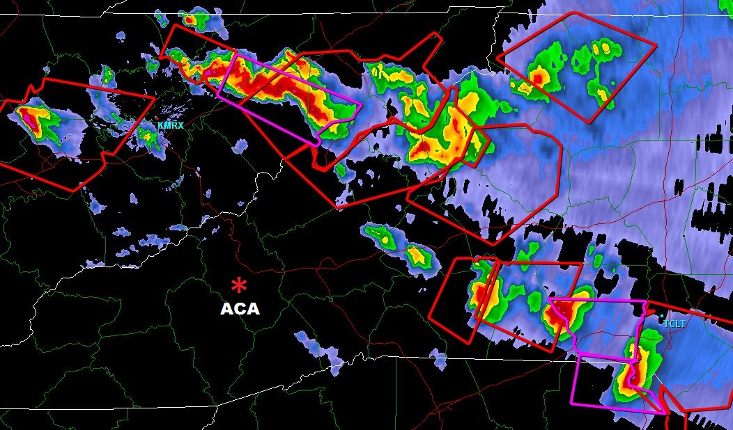 | |||||
| 540p Knoxville radar scan; cells moving E/SE |
 |
| Potential funnel to left, east of Shelby on Highway 74 |
 | |||||
| swinging around looking SE into SC with funnel on the right |
No comments:
Post a Comment