UPDATE: Been talking with Chris Martin and APPLE CREEK ROAD IS IMPASSABLE AT THIS TIME. DO NOT ATTEMPT TO DRIVE IT!
An ultra fine mist has continued to fall this afternoon and evening, and I'm now at 19 degrees (5pm). My driveway has a deceptive coating of ice, and the NWS office at GSP has put us in a Winter Weather Advisory until 10pm for freezing drizzle, basically. The odd thing is our low may hit single digits, so what ice has formed will not go anywhere anytime soon. Apple Creek Road is exceedingly dangerous and will be for some time.
In checking with the GSP chatroom, there have been numerous accidents in Buncombe, Henderson, and McDowell Counties due to the icing. I-40 West at Old Fort has been shut down over the pass. It takes very little ice to make a royal mess of things, and we have a VERY royal mess. I don't expect to see 32 degrees at the end of Staymon until MAYBE Wednesday (very iffy)...beyond that, 32 won't get here until Sunday.
I'll holler with any other information as I get it.
Bob
Sunday, December 31, 2017
BITTER COLD ARRIVING
 |
| Meme I wrote with Maisy from the earlier snow :-) |
Woke up to a heavy dusting of very fine powdery snow this morning... that's what a 20% chance of snow will do fer ya. Temp holding around 21 degrees this morning...there is no icy belly to the coating, so not anticipating trouble getting down my driveway shortly.
My 'heads up' is for the newer residents here that may have never checked their well heads (for most it's under a large plastic 'rock' cover). With single digit lows ahead (even giving 0 a run for the money), you want to make sure there is adequate insulation around those pipes. Lowes sells a small roll of fiberglass batting that is perfect for the job, but even towels wrapped around it will help.
One interesting thing when temps get that low is that you'll hear what sounds like .22 rifle shots as the deck and trees contract. This cold snap will last through Friday, at the very least, so batten down the hatches. As for me, that also means dripping the kitchen faucet...
Bob
Wednesday, December 13, 2017
NWS SNOW MAPS OF OUR SNOW
The National Weather Service office at GSP has put together a map of the regional snow totals that some of you might find of interest. On the page, click on the graphics to enlarge them.
Click HERE.
Some roads on the mountain are left with serious ice issues still; ice melts far more slowly than snow, and it's not going to improve all that quickly. Milder temps are on their way in in a few days, and some rain Sunday will help, as well.
Bob
Click HERE.
Some roads on the mountain are left with serious ice issues still; ice melts far more slowly than snow, and it's not going to improve all that quickly. Milder temps are on their way in in a few days, and some rain Sunday will help, as well.
Bob
Monday, December 11, 2017
WINTER WEATHER ADVISORY
After a warm afternoon, relatively speaking, here comes more cold. ACA is under a Winter Weather Advisory from 4am Tuesday until 7am Wednesday. A strong NW flow clipper will be moving in, with increased winds, dropping temperatures, and the chance for light snow. The Advisory calls for up to 2" of snow, but I believe most of that will stay closer to the TN border.
In fact, my models are still going 0-1", with the 2-3" range relegated to the Max Patch to Roan Mountain complex, well away from ACA. If I wake up to snow and a dusting already by 6am, that won't bode well for schools, etc.
Apple Creek Road had improved this afternoon, though there are still plenty of snow/slush/ice patches higher up. The incoming cold will halt a lot of our melting for a few days, though the weekend ahead looks milder and promising.
If you didn't see the prior post, the minutes to the ACA HOA meeting in August have been posted. Be sure to read them if you haven't done so already.
Bob
ACA HOA ANNUAL MTG NOTES
(Here are the minutes from the August HOA meeting as
prepared and presented by the board)
__________________________
ANNUAL BOARD MEETING
Annual Meeting Minutes
Apple Creek Acres Homeowners Association
Date of Meeting: Saturday, August 26, 2017
At 10:30 am, August 26, a quorum of 65 votes was reached. The meeting was called to order by President Owen Fulghum. He agreed to preside, and appointed Doyle Love as Parliamentarian.
The minutes from the 2016 Annual Meeting were read. There were no additions or corrections. A motion was made by John Saunders to accept the minutes as presented. The minutes passed.
President's Report: Owen Fulgham reported on the improvement of the roads. Challenge of covenants was discussed. Owen has been in touch with the county to insist that permits are being addressed. Rocks are under the guidance of the county for erosion control. Greatest challenge within the association is keeping up to date with homeowner details. Communication should be improved between board and homeowners in order to improve homeowner / lot database.
Treasurer's Report: Tom Batchelor presented the Expense and Revenue Report (see attachment). He mentioned that as of August 1, we had a balance of $23,816.51. Delinquents were discussed. There are 16 properties that have not paid their dues. $500 is still due to us from a foreclosure. Approximately 5 properties will be brought to the attention of the lawyers and liens will be filed.
Roads Committee: Keith Patton presented for Jeff Hintzman on the road work done in ACA. We are on the list with the paving company. In the next two weeks, they will be in touch with Jeff H about the road closure and paving. They will start at the top and work their way down. The road will be closed. It was stressed that residents need to plan around the road work and do not drive around the paving crews/areas. We appreciate everyone’s assistance in advance. There were 2 culverts replaced, but there was a failure, and one had to be fixed. The culverts that are currently in place will need to be replaced every year because they are old and failing. It was recommended that we put off the culverts on the paved roads until the roads are replaced, so everything can be done at the same time. Fixing the roads should be a priority.
Nominating Committee: Cheryl Folghum presented the 5 nominees for the new board. A motion was made that the board be kept at 5 members, and the motion was carried. The five HOA members nominated were Tom Batchelor (President), Jeff Hintzman (Vice President of Roads), Fay Grant (Secretary), John Saunders (Vice President), and Lynn Strause (Treasurer). Owen Fulghum asked if there were any nominations from the floor; being that none were made, a motion was made to accept the nominations by acclamation. It was seconded and passed.
Old Business: There was none presented.
New Business: Problems with people speeding on the mountain was addressed. It was mentioned on the blog that there is a blue truck driving too fast on a regular basis. Many attendees agreed that the blue truck is a problem and to find out who the driver is. UPS and FedEx drivers were also discussed.
It was also addressed if escrowed money at the end of the year will be used for the culverts; but will be saved for potential snow storms and plowing.
Trees need to be trimmed to help with roads and ice prevention. Maintaining the road has to be our primary focus. You can join Next Door or check the Apple Creek Acres blog to keep updated on the community. Note to new board to attach new meeting minutes to dues notice to encourage participation.
New homeowners introduced themselves. It was asked for attendees to take a look at the current list of homeowners and make changes, if needed. Keith Patton and Jeff Hintzman were thanked for all of their hard work and mountain wisdom.
At 11:09 am, a motion was made to adjourn, and was seconded and passed.
MONDAY: ISSUES
We had a bit of an inversion last night as temps held around and above 31 degrees while it was in the lower 20s down low. It helped a bit...but in driving out this morning, Apple Creek Road, while plowed yesterday, is still mostly snow/slush/ice covered. I didn't have any trouble going down in 4WD snow hill-holder mode, slowly. Once you round the bend below the blue roof house, the road was plowed and salted earlier and in great shape.
There are black/bare places to put your tires all the way down, and temps today should get nicely above freezing. However, we have another NW flow clipper that might deposit a light layer overnight tonight and possibly again tomorrow night. I'm not going to post the model pics as they are 0-1" and most of the snow should hold a few miles on either side of the NC/TN border. If changes start showing up, I'll make another post.
Bottom line, just be very careful going up or down Apple Creek Road. I'll be posting the annual meeting minutes later today, FYI.
Sunday, December 10, 2017
SUNDAY UPDATE
The plow has been up and down Apple Creek Road. What salt was put down had not had time to work when I got to Apple Creek Road, shortly after the plowing. I imagine it's improving quickly by now.
Per side roads, all I know is that he attempted Staymon Road and didn't even make it to the Hughes' landing due to icy conditions. Maybe they got to other side roads, I don't know. I walked down to the bottom of Staymon and drove my vehicle all the way to the end of Staymon on the first try, with no serious slipping, so it's negotiable with a good 4WD system and knowing where to make your tracks.
After a low of 16 for me this morning, the temperature is pushing above the freezing mark, though barely. Tonight's lows will be well into freezing territory, nearing 20... refreeze will be widespread, with some black ice likely. Temps should warm up for us and help conditions Monday and part of Tuesday, but....
Another NWF (northwest flow) clipper system and colder air will pour in late Tuesday into Wednesday with the chance for more light snow (like last evening, ~1"). Hopefully there will be enough ground/road warmth to keep roads in passable shape. I'll post an update if warranted closer to that time frame.
I will be posting the minutes from the annual meeting late today or tomorrow. Just didn't want that post to get lost in the shuffle of road updates. Stay tuned.
Bob
Saturday, December 9, 2017
SATURDAY: CLEAN-UP TIME!

When I hear of plowing information I'll post it here. Refreshing this page will ensure you see it. Our regular plower had equipment issues and couldn't show up, but word is that another plower will be here first thing in the morning to begin clearing our roads.
I drove out this afternoon. No issues going down, though the usual steep, slick spots require close attention. Someone has plowed from Camry Lane down to the entrance, so that part is fine. 2WD cars will NOT be able to get up high and down. Coming back in, it was very slippery in the wet snow that packed to a slushy ice layer, but I got to Staymon. Staymon stopped me on the upper climb, so I threw in the towel. Just too much wet snow and steepness. The good news is I didn't have to call a tow truck to get me out of a ditch. :-/
I picked up 11" here at the end of Staymon, with temps holding in the upper 20s until today, where it is getting above freezing (barely). Tonight, low teens are in the forecast, so refreeze needs to be anticipated. Tonight there is a clipper system (and again Monday night), but both are "northwest flow" events, which means hit and miss snow showers with very light accumulations for us as bands of snow pass over the Blue Ridge from the northwest. In looking at the radar at 530pm, there's a decent fetch of moisture back into TN and KY, where the snow bands are coming from. The official forecast calls for around an inch in places like Max Patch on the TN border, and a dusting for ACA. Given our plowing situation, what's another inch if we were to get it?
This snow system was very unusual in that all the moisture trained SW to NE behind a cold front...the front slowed to a crawl and the moisture kept feeding in over us for many hours. Even Corpus Christi, TX got 6" of snow, the first snow for them since 2004. Normally our snows aren't as long-lasting as this one. You have to admit it's a gorgeous winter wonderland out there.
Be safe, y'all.
Bob
Friday, December 8, 2017
SNOW UPDATE (NEW POST)
We're under a Winter Storm Warning until 7am Saturday, with the NWS forecast of 4-6" and up to 8"+ above 5000'.
Too many changes to update last evening's post. It appears both the NAM and GFS are on point for a bigger snow. Days ago, the heavier snow band was forecast near the I-85 corridor, but every model run has pushed it northwest towards us, and is now planted in the mountains. Click on the pics to enlarge; ACA is in the red circle:
The GFS (which the past two seasons was more accurate) has us in the 8-10" category, but that would be the higher elevations. The NAM is back to 3-5" from 8-10" the prior run. I still see 6-8" as a reasonable possibility above 4500' though the going official total above the blue roof house (3500') is 4-6". A lot of this is a bit reminiscent of the 18" snow back 9 or so years ago, where the two models went bonkers at the last minute and the local forecast was far under what we got. Let the flakes fall.
The moisture plume over us goes back to the southwest all the way to the Mexico border, and is impressive. I woke up before 5am and the driveway was already white; Haywood County Schools are now closed. This has evolved quickly into a bigger event with all the right elements coming together, right on cue.
The snowfall will continue off and on through tonight, with a minor event Saturday night. This started and will stay all snow as very cold air moves in for a few days.
I'll update any information as necessary. I will be heading out in a few hours and (hopefully) heading back in. Time to give the new buggy and tires it's first snow adventure. :-)
Too many changes to update last evening's post. It appears both the NAM and GFS are on point for a bigger snow. Days ago, the heavier snow band was forecast near the I-85 corridor, but every model run has pushed it northwest towards us, and is now planted in the mountains. Click on the pics to enlarge; ACA is in the red circle:
 |
| GFS THU 8pm run |
 |
| NAM THU 8pm run |
The GFS (which the past two seasons was more accurate) has us in the 8-10" category, but that would be the higher elevations. The NAM is back to 3-5" from 8-10" the prior run. I still see 6-8" as a reasonable possibility above 4500' though the going official total above the blue roof house (3500') is 4-6". A lot of this is a bit reminiscent of the 18" snow back 9 or so years ago, where the two models went bonkers at the last minute and the local forecast was far under what we got. Let the flakes fall.
The moisture plume over us goes back to the southwest all the way to the Mexico border, and is impressive. I woke up before 5am and the driveway was already white; Haywood County Schools are now closed. This has evolved quickly into a bigger event with all the right elements coming together, right on cue.
The snowfall will continue off and on through tonight, with a minor event Saturday night. This started and will stay all snow as very cold air moves in for a few days.
I'll update any information as necessary. I will be heading out in a few hours and (hopefully) heading back in. Time to give the new buggy and tires it's first snow adventure. :-)
Sunday, October 8, 2017
WEATHER UPDATE
The remnants of Nate are bringing us much needed rainfall here in western NC now, but already there has been a rash of tornadic cells in the Upstate of SC this afternoon. The wind field will get here soon, and I imagine some trees can come down, and maybe power outages, as well. The tornado threat is greatly reduced here in the mountains as the storms are coming out of the SSE, so the high peaks of the Parkway will break up a lot of the circulation needed for a tornado. Can't rule one out, but % chances are very limited.
The remnants of Irma brought us just under 2.5 inches of rain (and brought down a sizeable Hickory tree narrowly missing my LP gas tank, so the gift of rain brings its concerns, as well. I had heard of springs running dry this summer, and since Irma we've had high pressure giving us warm beautiful days and nary a drop of rain. However, per the US Drought Monitor, western NC is not under a categorical drought.

Soon enough our pattern will change and we'll have more rain chances and more typical fall temperatures shortly. Oh, and lest I forget, our paving looks great, so thanks for everyone's patience and understanding...and thanks to our board's Jeff Hintzman for his overseeing it all.
Bob
Friday, September 22, 2017
PAVING DATE: 9-26
Assuming our good weather will hold, Custom Paving will be working on Apple Creek Road this coming Tuesday, September 26. This will most likely be an all-day event, starting by 9-ish, give or take. A reminder sign will be placed at the entrance, as well.
The past few years we have had great success by having residents stay off Apple Creek Road and not drive around the paving areas, which prematurely damages the edges of the road. Everyone's help in this matter is greatly appreciated in advance.
Bob
The past few years we have had great success by having residents stay off Apple Creek Road and not drive around the paving areas, which prematurely damages the edges of the road. Everyone's help in this matter is greatly appreciated in advance.
Bob
Sunday, September 10, 2017
"IRMA" AND STUFF...
 |
| 8-26-17 sunrise through a Cherry tree, end of Staymon Road |
"Irma" has certainly been the headlines, so no need for me to rehash the latest. Those here in ACA have really enjoyed the crisp mornings in the 40s of late...that trough in the jet stream has been lifting NE, opening the atmospheric door for Irma to travel further west, now up the west coast of peninsular FL and curling from Columbus, GA into western TN before stalling a tad.
We'll get breezy, if not windy, with sporadic bands of rain, heavy at times, Monday and Tuesday. Models paint a 3-5" total for most of western NC, though I think 2-4" may be a tad more accurate for ACA. We need the rain...our drought has not been in the news, but portions of our region are well short in the water department, so anything we can garner would be appreciated.
My only concern is that as I'm heading down at 7am to head to Waynesville Middle School that I round a bend to find a big tree across the road. I know a few others may proceed me, so hopefully we'll still be fairly mobile on the mountain. We do have paving that is already a tad delayed, and will continue to be more delayed, as the paving company works around the wet weather and adjusted schedules. We'll be sure to alert everyone as to the timing of our paving for the fall.
The annual HOA meeting last month went off without a hitch, and as soon as approved minutes come my way I'll pass them along. You'll also get them with the end-of-year assessment/dues. Looks like we're on track and on a 'normal' pattern for now in ACA.
Bob
Wednesday, August 23, 2017
HOA REMINDER...AND THEN SOME
First, the all-important Apple Creek HOA is this Saturday, August 26th, at 10am at the Waynesville Public Library. Proxies are oh-so important for voting on board members and other items, so I trust y'all have returned all that was needed. A quorum of around 64 votes is needed to even hold the meeting at all.
A resident just wrote about a concern of a driver in a smaller pickup truck squealing tires and driving dangerously...and I thought this was a great opportunity to remind our current lot owners as well as to prime our new lot owners on how things work here.
Apple Creek Acres is a tranquil place. It's noticeable when certain individuals act contrary to that, driving dangerously, making excessive noise, etc. Sometimes they are part of lot owners, sometime renters, sometimes none of the above. I live at the dead end of a dead end road, gone most days, now, so I don't hear or see issues. But some of y'all do...
First, note any description possible, especially a tag # if you can get it. Note any special times of day that you are hearing it, which may be a smoking gun. Color of vehicle. Time of day. Age of vehicle. Is it a pattern? Note it.
You CAN call the Haywood County Sheriff's Department at 828-452-6666 with specific information, and they can come in here, even though we are private roads. Or you can ask around and see if this is a resident in some capacity and see if the board can contact them. Owen Fulghum is our president, and he can be emailed at owenfulghum@gmail.com. Of course, our HOA meeting here in just 3 days is a great place to bring this up.
I hope this all helps. I am in love with living in Apple Creek, and I disdain rapscallions up here, as does everyone else. See y'all Saturday if you're coming... :-)
Bob
Wednesday, August 9, 2017
SOME UPDATES...
 |
| 6-30-17 late afternoon, end of Staymon Rd. (click to enlarge) |
I just got word that our annual HOA meeting has been set and the letters will soon go out. It will be held Saturday, August 26th @ the Waynesville Public Library. [I think that will be around the side on the lower level, where the massive book sale is held]. I want to impress to everyone again how important the proxies are that will be in the mailed information. If you do not plan on being at the meeting, please get your proxy to anyone attending, marked with your information, so we can have a quorum to hold the meeting and vote on various items.
At this time, paving will occur roughly around the last week of August (though weather can affect this). The pavers will contact us when they can give a more accurate timing; rest assured you will not be caught off-guard. Information will be posted in advance here and at the entrance so we all can plan accordingly.
There is one more event that is taking place this weekend I forgot to mention. This year's Perseid meteor shower is supposed to be rather spectacular, some meteors possibly seen during daylight hours. Peak activity will be this Saturday @1pm, which means the darkness overnight Friday and again Saturday should provide good viewing, even with the 3/4 moon. The potential bummer is cloud cover and our weather; currently, the forecast is for cloud cover in the 60%+ category, with limited rain chances. Click HERE for more information on the Perseids.
Bob
Monday, August 7, 2017
'BOUT THAT TIME...
 |
| FRIDAY 8-4-17 SUNRISE (click to enlarge) |
Now that August is here, we have a few things on our plate in Apple Creek and the immediate area.
First, the annual homeowners meeting is supposed to take place in August, but first all lot owners must receive a notice (and proxy) 10 days in advance of the meeting. At this time, I have no information on that from anyone on the board. When I do, I will post that information as a back-up to the mailed copies going out. The proxy is very important if measures are to be voted on, as there has to be a quorum to even hold the meeting in the first place. Those proxies count as one owner each, so returning them quickly is important.
The white painted marks on Apple Creek Road signal our main paving event for the year is coming up...but at this time I don't know when that is. As soon as I hear from Jeff or someone I'll give you a heads up. We have had a few years of very successful paving results by stopping all traffic for as short a period as possible, to let the pavers do their best job. Letting cars go off the side of the new pavement to go around the work prematurely breaks down that important edge, and we'd all like our $$$ to be used as wisely as possible. There are a good number of us that work daily, among others who have various appointments, etc. Usually there will be a large sign about the paving posted at the AC entrance, as well. Paving is usually slated around a window of time, as weather (like the rain this morning), moving of large equipment, and the juggling of other jobs the pavers are involved with, all can affect the planned timing. I'll do my best to keep you up to date as possible.
Schools are cranking back up, which means kids along the road waiting for the bus, more traffic, etc. I believe Shining Rock starts back this week, and Haywood County Schools start back August 22.
We're all aware that Monday August 21 is a huge day for the region, the total solar eclipse. Waynesville proper is in the 99% totality, but go as close as Balsam and you get into the 100% totality. Traffic is expected to border on ridiculous, so reports say...and animals could exhibit odd behavior as well. If you are out on the roads, drive with extra caution in anticipation of, well, just about anything. While we're all aware you must use approved solar glasses to witness all but the actual totality, do NOT point your camera or cell phone directly at the sun as it could fry your sensors...unless you have the lens covered with the same protective lens. NASA has a wonderful site on the event...scroll down on the link below and click on Map #8 and you will get an extremely detailed map of eclipse details, as in times, length of totality, etc. Some of you will need to then click on the image to make it much larger. Click HERE to go to that site and poke around.
Bob
Wednesday, May 10, 2017
SPRING PICS
What gorgeous weather we're having now, after a chilly hit last weekend. Over the past month, maybe more, all the gravel roads got graded and some graveled, and the lushness speaks for itself. Picked up several inches of rain that has aided the vernal explosion, as well. No real information to share at this time, just....
...a bunch of pics I've taken from the end of Staymon in the past several weeks. I wanted to get more wildflower pics to show, but here at least are a few if some wanted to identify a lot of those visible from the drive up and down the mountain. Click on any pic to enlarge.
Bob
 |
| Easter morning sunrise |
 |
| Dwarf Larkspur |
 |
| Large Flowering Bellwort |
 |
| Dutchman's Breeches |
 |
| Squirrel Corn |
 |
| Canadian Violet |
 |
| Wake Robin Trillium |
 |
| Star Chickweed |

 |
| One of my favorite shots :-) |
 |
| How those rainbows can vary! |

Tuesday, April 4, 2017
ROUGH RIDE AHEAD
(early Friday AM updates in red)
I didn't bother to talk about Wednesday's chance for strong to severe storms earlier because with the incoming storm direction coupled with the height of the Smokies and the Plott Balsams, many storms are prone to get worn down in severity as they pass through here....or at least the storms get broken up and the severe parts are spotty in nature.
Be that as it may, it might be boisterous here tomorrow afternoon and evening, with strong straight line winds and hail the bigger concern. ACA has just been dropped back to "slight" chance for severe...but it will still be very windy, which could lead to downed trees and power outages. Tie that in with continuing strong winds for a day and a half, incoming cold, highs staying in the 40s Thursday and Friday, and a rain-snow mix that may well go to all snow above 3500' late Thursday closer to midnight through early Friday...it's an UGH situation all around the board.
Good news is the ground will be warm, so not anticipating icy roads. Slushy, maybe, and that's plenty slippery, but afternoon highs at least go nicely above freezing to help keep roads good. I still could see 1-2" for ACA, especially above the blue roof house. The "sleepy" NAM has gone bonkers pushing 4-5" here, but the more 'steady' GFS is keeping us in the dusting-2" which is what makes more sense. (Amounts listed still holding at this update.)
Early April has given us big snows going back in years, so this is a minor event, truly. I just want to get information out for those that might not have 4WD vehicles that need to move around. Winter coats will be appreciated with the windy cold conditions soon to be here.
On a brighter note, I took some pics this afternoon of the early, mostly 'white' wildflowers now out. Even saw the buds to the deep purple Dwarf Larkspur waiting to bloom later. Pics below (click to enlarge):
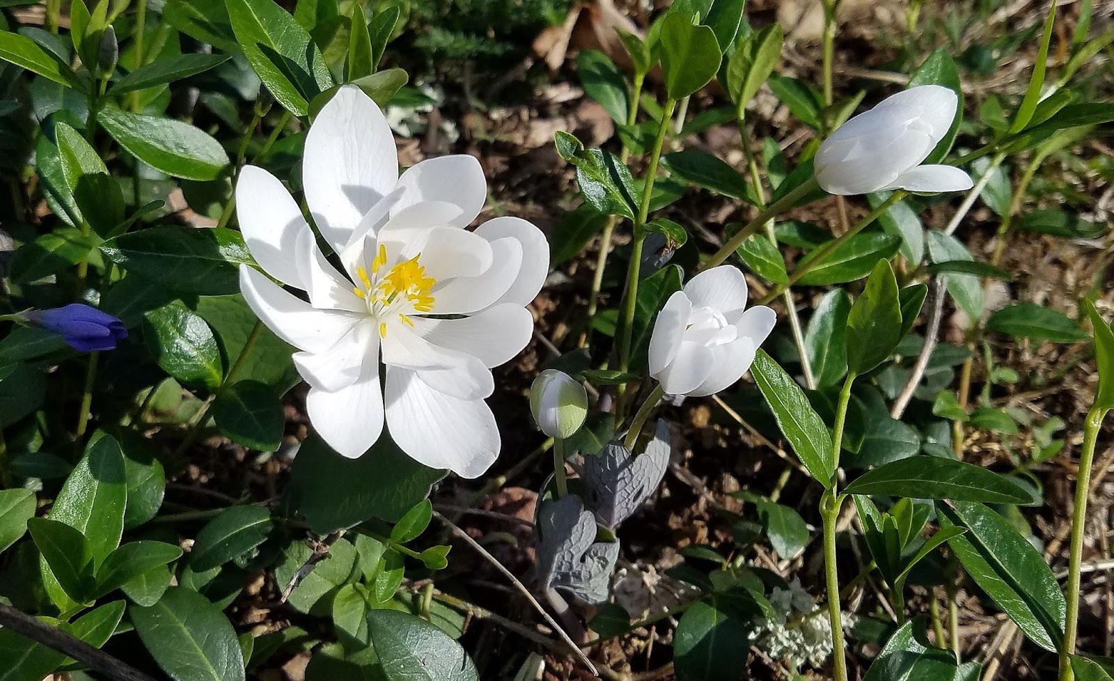 |
| Bloodroot |
 |
| Spring Beauty |
 |
| Cut-leaved Toothwort |
A BIT OF SNOW, PERHAPS?
Sometime around midnight Thursday into Friday morning, cold rain showers should switch over to snow, certainly above 3500'. Good news is that the ground temp will be above freezing, so I am not anticipating road issues, but if it feel hard enough for a bit it may lay down an inch or two on grassy/wooded areas. And if it were to lay on Apple Creek Road, it will not be frozen and just a slushy texture.
Friday will be a chilly April day with highs only in the low to mid 40s on most of the mountain, but at least it will be above freezing. From Friday through Sunday mornings, lows will flirt around if not below the freezing mark before warming up some next week (Spring Break for Haywood County Schools).
The above shots were from Sunday morning at the end of Staymon (click to enlarge). If there is to be color at dawn's light, there is usually a burst of strong color for 1-3 minutes, called the morning 'glow'. It was nice to see and drink coffee to on the deck. And to my surprise, Bogart has not returned to my house in days. I'm okay with that...I like sleep. ;-)
As April goes on, you will see quick changes to the greenery on the forest floor...Bloodroot, Cut-leaved Toothwort, and Spring Beauty are well-flowering, with Trillium leaves already out around my house. Trout Lillies, too. It's a glorious time.
Apple Creek Acres is considered a safe haven, safe to say. However, as it warms, there is an increased possibility of ne'er-do-wells snooping around...which is where our Community Watch comes in. We're only as safe as our least 'watchful' resident...if you see suspicious activity or vehicles, try to get a good description and a tag number if possible, and call the Haywood County Sheriff. There is an officer dedicated to Apple Creek, and they do a great responsive job in keeping us safe. Keep this number handy:
Friday will be a chilly April day with highs only in the low to mid 40s on most of the mountain, but at least it will be above freezing. From Friday through Sunday mornings, lows will flirt around if not below the freezing mark before warming up some next week (Spring Break for Haywood County Schools).
 |
| Dawn color bouncing off of Lake Junaluska |
 |
| Good ol' dawn color April 2 |
As April goes on, you will see quick changes to the greenery on the forest floor...Bloodroot, Cut-leaved Toothwort, and Spring Beauty are well-flowering, with Trillium leaves already out around my house. Trout Lillies, too. It's a glorious time.
Apple Creek Acres is considered a safe haven, safe to say. However, as it warms, there is an increased possibility of ne'er-do-wells snooping around...which is where our Community Watch comes in. We're only as safe as our least 'watchful' resident...if you see suspicious activity or vehicles, try to get a good description and a tag number if possible, and call the Haywood County Sheriff. There is an officer dedicated to Apple Creek, and they do a great responsive job in keeping us safe. Keep this number handy:
828-452-6666
Bob
Thursday, March 30, 2017
BOGART IS OUT AND ABOUT :-)
 |
| NO, THIS ISN'T BOGART. THIS IS A TEASE SHOT...AS APRIL UNFOLDS, OUR MOUNTAIN WILL EXPLODE WITH A GORGEOUS WILDFLOWER DISPLAY THAT IS ALWAYS EXEMPLARY! |
We have had a nice influx of new residents here, so you may be reading this type of information for the first time. Welcome, y'all! It's no surprise to the rest of us, of course...bears are part and parcel of life here in ACA. I've called this particular bear Bogart in honor of the Waynesville restaurant flooded with carved bears.
Best I can tell this is the same one I had last year, and I'm guessing it's now 3 years old. Its color was a bit washed in the face and body last year, but I have to say it's a very handsome bear now, good and black with the clear brown marks on the head area. It's just not very big as adult bears go. I didn't have the camera ready when he came to and on the deck I don't know how many times from 1-3am, but I got my army of bird feeders in before there was an issue. Bogart did not like the chorus of Maisy and Molly barking their fool heads off on the other side of a glass door just three feet from the golden path to the bird feeder area.
And so the word to all to bring feeders in at night and don't leave garbage and food scraps available to our visitor. It's in its best interest to eat as nature intended and maybe it will move on...or not. There's a big chunk of real estate east of my house all the way to Hall Top that I imagine was its den area this winter. And who knows, it won't be unusual to have other bruins cruise through from time to time.
As an aside, I have made a tweak to this blog so it should be easily viewed on mobile devices. Sorry for that delay.
Bob
Tuesday, March 14, 2017
TUESDAY P.M. UPDATE
Well, I've picked up around 3" of new snow today here at the end of Staymon, albeit with whippy winds at times and some melting earlier. Apple Creek Road has been in perfect shape from even early this morning; however, the temp is now down to 27 degrees just before 6pm and it's only downhill from here.
The NW flow snow showers will continue intermittently through the night and possibly well into Wednesday. The Winter Weather Advisory for Haywood County is through 8am, but I'm seeing a massive upstream moisture flow that will not go anywhere quickly as the parent low pummeling the northeast is starting to recurve slightly NW.
It's possible to pick up another 1-3" overnight. Driving up this afternoon, the snow was relatively absent below the blue roof house (relatively, I say). Accumulations will continue to be higher in the upper elevations above 3500'. What had been a non-icy Apple Creek Road can easily become more icy as time wears on, so a big concern for travel in the morning as well as school schedule concerns.
Bitter cold is incoming, so what falls sticks and stays. We'll ever so slowly start warming up by Friday, but until then the bitter cold will reign. Gusty winds increase our danger for power outages, as well, so prepare for that for the next 24-36 hours.
Wheeeee. Way to go, Punxsutawney Phil....
Bob
TUESDAY A.M. UPDATE
As I write I've got about 1.5" of wet snow with the temperature hovering around the freezing mark. Even though I salted my driveway last evening, it's snow covered, but temps haven't been cold enough to freeze the slush (yet). Slush is perfectly slippery, but I'm not anticipating any trouble getting down (cautiously) in AWD. Highs will go above freezing (even if just a little), so we should have some road clearing later today. Problems come in tonight if not enough melting takes place on Apple Creek Road.
Bands of intermittent snow showers will continue today...radars don't look impressive this morning, but a lot of the bands are under the radar beam and not readily visible. Light accumulations are possible if the bands are heavy enough.
Bitter cold moves in tonight and locks in for a couple of days. Tender vegetation will take a nasty hit. Any snowy or icy areas will stay put, hence the heads up if roads don't clear adequately today.
Bob
Monday, March 13, 2017
WINTER WEATHER ADVISORY
Looks like the colder air is coming in colder and a little sooner for this next event tonight through Wednesday morning. Precipitation should start late today/tonight as a rain then wintry mix before going to snow before sunrise Tuesday. If the rain component doesn't develop, then just a bit more snow will total. Off and on snow showers may fall through Tuesday and Tuesday night, tapering off early Wednesday morning.
The Winter Weather Advisory is in effect from 8pm tonight through 8am Wednesday. Higher elevations could see up to 6", but the winds and wind chills will be truly bone-chilling. Power outages a real possibility. Current NWS totals range 1-3" with a chance for initial sleet and freezing rain (think ice under any snow).
Amounts I see range 1-3" for the event at this time on my models, though those models have been trending slightly heavier. WLOS just posted their guess for us as 2-3". Same idea. It doesn't fall all at once, just some here and there as the bands move through.
The inescapable is the flower killing cold coming in, with Tuesday AM lows in the upper teens, and even a tad colder Wednesday and Thursday morning. Bad news for our budding and flowering plants, fruit crops, etc.
So, a heads up for Tuesday travel...with such temps, what falls is sticking and going nowhere, and for our new residents in ACA, even a half inch of snow on Apple Creek Road can be a nightmare on the steeper problem sections. Be careful.
Bob
Sunday, March 12, 2017
SUNDAY P.M. UPDATE
 |
| Noon today from the end of Staymon (click to enlarge) |
Apple Creek Road is in wonderful shape...just be careful early in the morning for icy areas from snow melt crossing the road. What a great day for snow melting, giving much needed water for the soil horizons. Zero issues anywhere, except for maybe shaded roads in higher elevations.
On Monday, don't be surprised during the day if you see some rain fall with snow and sleet mixing in. It should not amount to anything before switching over to a very cold rain for the rest of the day and night. I'll post later when the Tuesday-Wednesday AM scenario unfolds.
Bob
SUNDAY A.M. UPDATE
Topped out at 4" here at the end of Staymon. I'm glad the heavier precipitation stayed just south of us, and with the sun out fully now, and highs expected to get well above freezing, we should get some good melting.
10am UPDATE: With our plower out of town, another person will be here shortly to plow and salt. Give it a little time and the road should be in good shape.
Round #2 begins to arrive Monday with a rain-sleet-snow mix possible before going to rain for us. The northern mountains will get more snow, but a warm 'nose' aloft should keep us in rain Monday night. Later on Tuesday, we may see rain showers switch over to a little snow into the night time hours. At this time, there is no discussion of amounts. I'll most likely post an update Monday afternoon.
Bob
Saturday, March 11, 2017
WINTER STORM WARNING:UPDATE
DON'T FORGET: Set your clocks forward tonight one hour as Daylight Saving Time begins.
This is going to be a brutal week on budding/flowering plants and trees. The SC peach crop stands to lose 90% of it's crop later this week with lows here in the upper teens and low 20s possibly in the Upstate. Nature can be a hellish wench.
(I'm making changes lowering snow amounts...the upstream moisture looks to be pushing even further south, just out of our hair...warning is for 2-4" of snow for all of us, and even that seems doubtful as I write around 4pm. However, the NWS is still pushing bouts of snow overnight for the accumulations, so just maybe they see something I'm not seeing right now.)
In front of us is incoming snow and cold:
I'm culling back totals to 2-4" for all, which I am even having my doubts about those. The upstream moisture field is impressive, but pushing even more south of us toward Franklin. Tonight, temps may be below freezing for about 12 hours. Any snow that does fall will most likely be icy underneath.
-------------------------------
(older data with impressive snow....that seems evasive now) The Saturday AM runs look similar, so here are the graphics I already saved and marked from last night's model runs for the NAM and GFS. The nod for a while has gone to the GFS, but for me, seeing the NAM so hot and heavy, I know there is a decent chance this snow may go deeper than forecast. All that to say truly do get what you may need for a couple of days as the cold will be here to stay this week. (click on graphics to enlarge)
 |
| GFS Friday 8pm run |
 |
| NAM Friday 8pm run |
 | |
| Experimental product from NWS |
Onset has been accelerated to this evening, with the likely times of heavier snow just before midnight and just before sunrise. All should be done mostly by noon Sunday.
The next hit will be late Monday into Tuesday...what originally looked like another 4" of snow for us is now more a really cold rain that may see sleet and light icing occur intermittently. A "warm nose" may be overhead here in the mountains, stopping the snow event, so for now we may dodge worsening conditions. More on that as that time nears.
For now, enjoy the calm before the snow, remembering that being a heavier wetter snow will mean increased chances for power outages and downed trees.
Bob
Friday, March 10, 2017
WEEKEND WEATHER: SNOW COMING
 |
| Boomer (red squirrel) picking out a peanut |
I'll be posting an update Saturday afternoon, but for now...let's just say we knew we were going to pay for all of our unseasonable warmth this winter. Next week will be one of the coldest in quite a while, and there will be another chance for accumulating snow in the first half of next week.
Before us is a colder day today, ushered in by thunderstorms that rumbled through around 3am today. Winds will be whippy, too, and a secondary/trailing cold front is on its heels. More rain will fall late Saturday and overnight, when it changes to a wet, heavy snow. Those types of snows accumulate quickly, and bring with them increased danger of falling trees and power outages. The switchover looks to take place in the black early morning hours Sunday, so that we wake up to travel issues.
How many hours we stay below 32 degrees will dictate the extent of road troubles in ACA. With our warmth, the ground is warm, and with this starting as rain and transitioning to snow, the belly will be wattery. Slush is very slippery on it's own, but if it stays below 32 long enough, the belly goes to ice and makes a mess of travel. Sunday afternoon highs are supposed to get above freezing, but with a snow cover that will cut a few degrees off.
A few days ago, temps looked like a heavy wet snow that mostly melts in the afternoon. But the temp runs have gotten colder and colder, and the snow amounts have been CRAZY in my two favored models. Last night's 8pm model run showed the NAM pumping 12-14" here and the GFS going 10-12"....a tad reminiscent of the 12/18 18"snow 6 years ago. The 1am runs backed off to the 4-6" range again where most of the runs have been. The NAM has been the hotter pushing 6-8".
The problem in this case with accumulations is the amount of falling snow that melts and mixes with rain, which could consume 2-3" of snow....next to impossible for any real accuracy. The local stations are pushing 2-4" which seems reasonable per the above. But suffice it to say Sunday morning will be a mess from top to bottom in ACA as accumulating snow should reach the valley floors, as well. Precip should taper off by noon.
I'm assuming we'll be under a Winter Storm Watch by Saturday, and I'll reassess then. Too, by then, I should have a better peak to the second chance for snow a day or two later.
Bob
Monday, January 30, 2017
ROAD CONDITIONS
2:45pm UPDATE: Just got back home, had to turn around at Moskos/blue roof where I met salting crew. From Rich red roof down to the bend it was solid ice, with one car off down over the side (all the info I have). They said give it a good hour and it shouldn't be a problem any longer. That was around 2:15pm. I'd imagine that by 3:30pm it should be far better to navigate.
In any snow, especially light ones, the first few cars down or up may well make it...once the tracks get packed down, it can flash to solid ice in an instant.
Look for refreeze tonight, but afternoon highs Tuesday are supposed to warm up a good bit and greatly help to get roads out of trouble spots.
Feel free to add any reports you have in the comments section.
Bob
Sunday, January 29, 2017
WINTER WEATHER ADVISORY
Unlike the last event, we don't have arctic temperatures hanging around as temps will rebound fairly quickly. I will post any new information in a new blog post as needed.
For now, adding in some photos I've taken recently, some from home at the end of Staymon as well as my goal to capture portraits of some of the flyway ducks that are at Lake Junaluska right now. Click on any pic to enlarge.
 |
| Lesser Scaup drake @ Lake Junaluska |
 |
| Dawn at end of Staymon 1-17 |
 |
| Redhead drake |
 |
| Neat clouds after early AM rain 1-1 |
 |
| Ring-bill (Ring-neck) drake |
 |
| Canvasback drake |
 |
| American Coot (actually a rail, not a duck; very common with ducks) |
Bob
Subscribe to:
Posts (Atom)