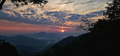
Sunday, December 17, 2023

WINTER WEATHER ADVISORY...???

I'm scratching my head over this one...NONE of my modeling shows anything above a dusting to MAYbe 1/2" of snow, and I've been watching these runs for two days.  Here's the 'official' advisory:

A Winter Weather Advisory is in place for Haywood County from 6am Monday through 6am Tuesday for elevations above 3500' (ACA's 'blue roof' house).  Snow to 4" and wind gusts up to 55mph.  The wind we'll get, and be prepared that some trees fall and cause some power outages, should the speeds manifest.

To be honest, I see those snow amounts only within a fairly narrow band of the higher elevations right on the TN border and the Blue Ridge Parkway.  Even the 'expected' NWS-GSP snowfall map for western NC has zero for Waynesville, and only starts accumulating a little within 15 miles of the TN border.  I'm just surprised, that's all...and a lot of people will be expecting inches of snow when it will be a skunk, mostly.  Any snow falling should be whipped around by wind and accumulations limited.

HOWEVER....some seriously cold air will be moving in. to the tune of lows in the teens Tuesday and Wednesday mornings...but temps do moderate by week's end.


Bob

Monday, December 11, 2023

6AM UPDATE

 My driveway is clear and dry as a bone.  While I see some shininess, it must be a very thin glaze that doesn't reach up to the level of the gritty driveway.  My boots never slipped, so I'm assuming most of us should be fine.  I won't be leaving until closer to 7am, and will update only if I see something worth mentioning.  I do have 0.5" snow/ice on my deck and stairs, FYI.


Bob

Sunday, December 10, 2023

UPDATE: SNOW AND SLICK ROADS POSSIBLE EARLY MONDAY

While snow flurries/showers are falling as I update at 6:50pm, almost all models have pulled snow totals far back for our area (except the HRRR, which I've never mentioned before).  While the NWS mentions 1-3" possible above 3500' elevation, I don't see the amount I got last Wednesday.  The deck is white, and the snow is falling...but there is a difference from last Wednesday....

Temps will be a dropping down into the low to mid 20s. What may be an additional concern is black ice forming.  Any moisture on the roads will be icy.  So just a heads up and word to the wise for the early morning.  I'll be posting any update on conditions around 4-ish as I get ready to head down the mountain.


Bob

Wednesday, December 6, 2023

QUICK A.M. UPDATE


 Drove off from the end of Staymon Road, with 3" of heavy wet snow at home.  Apple Creek Road was snow/slush covered until Altima Lane down low.  Several tell-tale fishtails seen.  Went slow, no problem. Valley roads are fine.  No other info as I'm in my yellow tin can sitting way up 276.

Tuesday, December 5, 2023

FIRST SNOW, ALBEIT LIGHT...

Doe in Cataloochee Valley, giving me a stare-down.

'Tis the season, of course.  A quick hitting shot of cold air with a limited moisture field will arrive tonight and give us a very cold Wednesday before departing.  As I write, we are simply under a "Hazardous Weather Outlook" (HWO) as opposed to a Winter Weather Advisory (WWA), but I expect that advisory to be posted some time later today.

It's a northwest flow event, which we all know is not a great snow producer in most systems.  If that NW flow sets up truly from the NW down the I-40 corridor to us, that will put down the expected 1-2" for Apple Creek, at least the upper half.  Down in the valleys, like Waynesville, I'm expecting a dusting to maybe 1/2" tops.

My bus route runs rural backroads from the end of Jonathan Valley to near Fines Creek, so I'm expecting a bit more out that way.  The spine of the Great Smokies could see 3-5"...going back to our actual flow, if it is more WNW, the Smokies will block a lot of our accumulations in ACA.  

All this to say this is a baby event, but it's a first.  It takes very little accumulation on Apple Creek Road to make it a skating rink, and it may well not snow enough to warrant a snow plow.  I'll update accordingly much later today and early tomorrow morning.

Saturday, December 2, 2023

'BOUT THAT TIME....

Apologies for the lack of posts from me, but there hasn't been anything monumental to pass along of late.  Alas, there are now several items that bear mentioning and 'food for thought' that serves us all here in Apple Creek Acres, so that'll make for a good fireside post.

By now, lot owners should have received our annual dues notice along with the minutes from the annual HOA meeting a few months ago.  You will notice the annual per lot assessment is now $300, up from $250.  We still can boast to having one of the most affordable HOA fees in the area, but as with everything else it seems, prices for goods and services continue to rise.  The oil component for asphalt is one good example, so our paving/upgrades take on bigger costs.  Insofar as winter weather concerns, I'll address that further into this post.  

I am now in ACA much more than normal as I stepped aside from driving tour buses out of Asheville and now work in the Haywood school system full time.  Two 'truths' come to mind:  1) nobody wants to be behind a bus, and 2) nobody wants to be on an HOA board.  While many HOAs have a bad reputation, we're in pretty doggone good shape here....except we're wearing out those that are currently serving because noone wants to come on board, so it would seem.  If that trend continues, we may have to consider moving to a third party to operate our HOA and there is nothing good to come of that, unless you are willing to fork out a significant annual assessment fee increase.  Just food for thought for now...but we really need residents to step up to the plate and help out if at all possible.  The time commitment is rather minimal, and you get one lot fee waived for serving.  Please mull the issue over...

This winter....if I could get a dollar for every time I get asked about "What's this winter going to be like?" I could comfortably retire.  Looking back over the winters since 2008, we have been in a bit of a snow 'lull' the past few years.  In terms of the Pacific Ocean currents that affect us here in the Southeast, La Nina has been in place the past 3+ years, but El Nino is now setting up shop, though we won't feel the full brunt of it this year, and not right away.  Climatology maps are showing moisture being prevalent in the Southeast throughout this winter, with temperatures trending downward from our above-average temps for November and December as we enter 2024.  Several models predict snowfall for western NC to be above average for the January-March period.  In the lot assessment letter is a smaller green sheet that goes over the Winter Weather Policy here in Apple Creek Acres.  Please read and take heed.

Personally, I'm agreeing with models anticipating more snow than usual here.  On December 18th, 2008, we got dumped with 18".  I've seen a few others in the 10-14" category, as well, but not the past few years.  This ol' body of mine is reaching a limit in my ability to manually push a 40" plow blade to clear my goony-golf driveway, so I invested in a great used UTV setup with a 6' plow blade.  It damn well better snow...LOL!  I've never been fond of long-term forecasts, but I watch incoming systems like a hawk and will be posting potential impacts here on this blog.


Until next time, saddle pals....


Bob


Saturday, September 23, 2023

PAVING! PASS THE UPDATE...

Just got word, so please pass it along: 

PAVING IS A GO for MONDAY, SEPTEMBER 25.

Apple Creek Road will be closed from 869 Apple Creek Road on up from 9am to 3pm

(NOTE: this is just before the downhill side of the mirror curve)


Bob

Thursday, August 24, 2023

ANNUAL MEETING REMINDER


[the above pics are some wonderful recent dawns/sunrises from home at the end of Staymon Road.  Click on image to enlarge] 

------------------------------------------------

By now surely everyone has received the notice for the Annual HOA meeting and the Board of Directors to be voted upon.

That meeting is coming up soon:

SATURDAY, SEPTEMBER 2

10:00am - 12:00 noon

WAYNESVILLE PUBLIC LIBRARY:  678 South Haywood Street, lower level (down behind back)

PROXIES: In your mailing was a proxy sheet and a self-addressed stamp envelope.  To have a quorum, the association needs X% of lot owners to either be there to vote in person, or at least turn in their proxy to be voted by the board or lot owner of your choice.

This is a great time to meet some new faces and catch up on the latest news, issues, and developments.  You'll find out about the director's reports, road maintenance/repaving topics, and other new business.

We live in a fantastic place with the lowest HOA fees around.  Hopefully you can attend...and if not, I pass on what information I receive via this blog.


Bob

Friday, July 7, 2023

FROM THE BOARD...AND AN EVENT!

 I've been asked by the board to post information concerning the upcoming annual meeting of our HOA in August.  At least two board members will be resigning, so if anyone is interested in helping out with the board, let them know.  The link to the board members and how to contact them is listed HERE, so feel free to ask away as to what's entailed with being on the board.

No doubt Jeff and Keith carry the board weight of dealing with road work, paving, repairing, etc.  But there are positions like treasurer, secretary, etc. that also help our HOA tick.  As long as we can staff within our own HOA, we can avoid having to do what so many HOAs around here now do, which is to hire outside organizations to run the HOA.  That might sound convenient, but our VERY modest annual dues would surely soar (double to triple) if we had to go that route...and for multiple lot owners, that would be a significant hit in the wallet. Our HOA fees are some of the lowest in the region...let's help keep it that way.

------------------------------------

Every first Friday from May through December, downtown Waynesville has an "Art After Dark" gallery stroll.  Well, July's is this evening, and specifically at the Haywood County Arts Council store front (86 N. Main Street), they're holding a reception for their new exhibit "Water" which is up through the end of the month.  I took several of my photographs to go on display, but I have no idea what is actually hung...but I'll be there at the reception which runs from 5p-8:30p this evening.  I can only HOPE they hung one of my faves, a bull elk lying down in heavy frost in Cataloochee Valley (hey, frost is simply frozen water!):


Too, in walking my pups in the grassy area beside Ingles off of Russ Avenue one morning, there was a dandelion pappus worthy of a cell phone shot with dew drops all over it.  I converted it to black and white and zoomed in...all taken with my Samsung cell phone:

So, that's all the news from Lake Wobegon for now.  Cheers.


Bob

Saturday, July 1, 2023

AN OUTDOOR IDEA....AND STORMS

 I had been planning on posting about an outdoor idea you may not know about, that I just discovered...but I'd better address the storm we had and the ones coming in tonight.

This afternoon's storm was one of the quickest developing storms I've seen in a while...and right over our heads.  I'm surprised we didn't lose power, given the copious lightning very close by.  We did enjoy a rather protracted hail storm with pea-sized hail (0.25-inch, some pieces close to 1/2"), but thankfully we didn't hit warning criteria (1").

We're not done yet...another round of storms and potential hail and damaging winds moves in tonight, moving almost due east out of TN.  Unlike our isolated Haywood storm cell this afternoon, this could arrive as a more widespread line when it passes through.  Just FYI.

-------------------------------------------

With a big holiday period upon us, some may be looking for something different to do outdoors.  I am prone to being a hermit and not keep up with news items in our area, but today we ventured to a new wonderful assortment of trails throughout the impressive campus of Haywood Community College (HCC).  "The Dahlia Ridge Trail" was unveiled just this past June and is full of well-cleared trails, allowing for hikes/walks as long or short as you'd like.  

Excellent signage ensures you will know how to get around, which trail you are on, as well as locator diamonds in case of an emergency which you can report if help is needed.  Too, for maybe younger family visiting, they have a challenging disc golf course all throughout the same area.  Where the Lake Junaluska path is wildly popular (for good reason!), you will often find the trails to yourself at HCC

HCC is a real feather in our county's hat, and has been for quite some time.  Weekday hours run from 6am til 11pm Monday-Friday, and 8a-8p Saturday-Sunday.  NOTE: Campus will be CLOSED Tuesday July 4.

To read more about it and see a detailed trail map, click HERE.

Happy 4th of July to all y'all!


Bob

Thursday, June 8, 2023

THE PLATTERS HAD THE PERFECT SONG...


"Smoke Gets In Your Eyes"...

By now you're probably aware that we are dealing with a great deal of hazy conditions and lousy long-range mountain views thanks to being downwind of a significant amount of fires raging in Canada.  It began a few weeks ago with smoke coming all the way down from Alberta, Canada, but more recently we're now being inundated with smoke from the eastern provinces.  Just yesterday New York City recorded it's worst ever air quality day on record, even delaying air traffic in the region.

Below are a couple of links for inquiring minds:

Interactive smoke map 

Another interactive smoke map

My allergic reaction to the smoke has been off the charts, as well.  Forecasts say that conditions will improve in a few days...but it does make for some fireball sunrises and sunsets, thanks to the thickened airmass.

Lake Junaluska's famous flea market at the outdoor gym is this Saturday, FYI.  8am-1130am.

Excellent road grading is now complete on our unpaved paths, so I no longer will feel like I'm driving a chuckwagon up and down Staymon Road.  :-)  Yippee Kiy Yay!

Please continue to drive cautiously on Apple Creek Road as there are more walkers and oodles of rabbits out and about.


Bob

Saturday, April 1, 2023

HIGH WIND WARNING STARTING SATURDAY

Sorry to say I'm not on the mountain for this, but the wind field heading toward our region is impressive, and not in a good way.  Power outages will be a real possibility from falling trees in winds that will be gusting to near 50mph in ACA.  It will be very breezy  Saturday morning, but as the afternoon rolls in so do the winds.  Wind direction is supposed to be WSW which means we'll get a little blocking, but the warning goes into early Sunday morning before winds diminish.  Batten down your hatches.


                                The End


Bob

Saturday, February 11, 2023

STORM IS FALLING APART...BUT....

More rain, more 'wintry mix', less snow...that's the going forecast for most of western NC, which limits accumulations.  The only problem is Haywood has had this bullseye which, although it's shrinking, still exists.  Barely, though.

The track isn't the real culprit, just the slowness of cold air to move in and work down to lower elevations.  Waynesville proper was 3"-4" on a National Weather Service graphic, and now it's down to <1", which I find odd since Haywood County is only in a Warning and that is not Warning criteria.  The NWS says to hang onto the bigger totals for now....there is that oh-so fine line  where rain turns to snow, and that wet snow piles up quickly.  Asheville has been dialed back to 'skunk' category...snow will fall there in time, but it melts either on contact or shortly thereafter.  Personally, I'm glad to hear that given my return trip. 

In light of the newer model runs and trends and yaddah-yaddah, I'll keep lower ACA in a 1-3" range and the upper ACA in a 3"-6" range, knowing it could go either way.  The uncertainty is high with all models, but I don't want us to get blindsided on the mountain.  Temps rebound, so if there are accumulations, even with nightly re-freeze, we should see a fairly timely disappearance of the snow.


Bob


SATURDAY 6:45AM UPDATE: CHANGES?...

[7:30am quick note:  My expected amounts for ACA from yesterday (3-5" lower, 5-10" upper, above blue roof home).  I don't mention it directly, but because of the bullseye I talk about below I'm letting it stand.]

I'm an early riser, so I headed down to breakfast at 6:15am....then had to do a face plant as weekend breakfast start times are later, in this case 7am.  SOOoooooo....a great time to go ahead and post this update (with coffee in hand, of course).

The following is a result of the track of the low...it appears it will come closer to western NC as opposed to staying down around Atlanta and Columbia as it heads to the coast.  What does that mean?  Warmer lower elevation temperatures (below 3,000', roughly). More mixing of precipitation types, and a 'dry slot' for some.  I'll go one by one...

1.  Asheville proper stands to see virtually no accumulating snow.  It will snow there, and maybe hard at times, but it will melt on contact with only some slight slushy accumulations before they melt.  That is bad news for Ashevillians wanting snow, and great for me sticking to I-26 and returning my bus.

2. There will be rain, sleet, and snow early on.  Snow will hit some heavy rate periods, accumulating as heavy wet snow, especially above 3500'.  Could spell power outages. Could see some light icing on top of said snow, too.  Accumulating snow was forecast down into the valleys, but not much anymore...with ONE EXCEPTION: Haywood County alone has this doggone bullseye over it which has been there for days. For all this downgrading trends, this is why I'm holding higher (read previous post if you haven't already).

3. Draw a giant comma.  Put a big "L" where the round part and the tail come together, that point.  That's a typical low pressure shape for virtually every storm, though it can be a weirdly shaped comma.  It is that space between the tail and the roundish body that is very dry air, and a precipitation killer.  If you hear weather reports talk about "dry slotting" that's what they're talking about.

Extra Credit:  I haven't talked about the gusty winds that should accompany this storm.  Heavy wet snow with a possible icy coat could well mean trees coming down.  Heads up.

Where are we?  A Winter Storm Warning is now in place for elevations above 3500', and a Winter Weather Advisory for lower elevations.  The interesting catch?  Haywood County is purely a Warning and not an Advisory that I can find, at least in our area.  Another reason I'm holding onto the snow/mix amounts for ACA and Waynesville.  Not a normal thing to see weather-wise, but Haywood seems to be magical for this event. In an event like this, there is a magic freezing level where the snow kicks in, and it's heavy wet snow that accumulates quickly and is much harder to shovel due to the weight.  I sense most of us, especially the upper ACA, will be in that transition zone.


Bob


Friday, February 10, 2023

FRIDAY 8PM UPDATE: CHANGES...

New year, first day dawn, 1-1-2023, from the end of Staymon

First and foremost:  the 'monster' totals in some models have scaled back to 'average' today.  Not that it won't happen, but that the potential has been downgraded a good bit.  Why?  Apparently the cold air will delay so that there is a longer period of rain-sleet-snow mix on warm ground, creating slush once the rate of precipitation outpaces the melting until the colder air gets in early Sunday morning.  That's for starters.

HOWEVER...however...for several days Haywood County specifically has been highlighted with the biggest snow totals of any place except for the northern NC Blue Ridge, so while many locations have scaled back today, I think we will still get a good dumping in ACA.  Down here at Clemson I still get WLOS, but while I have the luxury of focusing just on ACA, WLOS has to broad-brush stroke the regional forecast. Too bad, but I understand why.

WHAT:  We are under a Winter Storm Watch (click link) that will transition to a Warning at some point tomorrow.

HOW MUCH:  4"-10" of heavy wet snow with some sleet and maybe a thin ice layer.

TIMING:  Onset around darkfall and lasting through Sunday into Sunday night.  Surface temperatures will be everything.

TRAVEL:  At some point, it won't be safely possible on our mountain.  Apple Creek Road and side roads won't be plowed until the snow is pretty much done, so may not be done until Monday.  I'll relay what information I get when I get it.  I'll try to return to Asheville Sunday around 7pm with a 45' 53K-lb motorcoach, and at this time not convinced I'll be able to do that.  IF I make it, then I will try to get to Waynesville but at this time I hold no hope of being able to make it up to Staymon.  Just one of those things...

MY TAKE FOR ACA:  3-5" for lower ACA, and holding to the 5"-10" (up from my prior 8" high earlier) just because of Haywood being in a constant bullseye.

While Sunday will be a cold one, we'll have nightly re-freeze into the 20s each night with highs getting above freezing.  By the way, when your app tells you a high of "X" after a snow, if you have a solid snow pack, the albedo will lower that high by at least 6 degrees if not more, especially if you are in the shade.  Just sayin'...

I will have a small window to update if needed in the morning, but not again until this time Saturday night.  This might sound too obvious, but if you haven't already gotten a good supply of things, do it in the morning.  I would, just in case.  I really hate I won't be on the mountain for this one.


Bob

Thursday, February 9, 2023

SNOW "EXPLAINER" AND THOUGHTS...

 While I have a bit of time, I wanted to share some background information for those that might find it interesting, pertaining to this particular snow system.

It's too early for any Winter Storm Watches or Warnings to be posted, but they will be soon enough.  Some of you may have see this 'explainer' of the difference between watches and warnings using tacos, so for your chuckle here it is...and it's quite accurate for tornados, but with Winter Weather it's more like "Tacos are immanent"!


Next is my artful rendition of what has been going on for most of this winter (red line low) versus what's coming in Saturday (yellow line low).  The red track brought in some cold air but limited moisture (outside of the one decent snow we've had to date)...but we will watch an upper level low kick south out of the Arklatex, kiss the Gulf of Mexico to pick up moisture, with the low intensifying as it reaches the SE Atlantic coast and turns NNE.  That will suck in the needed cold air and supply it with water.


Now for those "models".  There is the GFS, EURO, and the NAM that we mostly watch for winter events.  The EURO seems to handle snow better than the others, while the NAM usually under-performs with snow.  The GFS and EURO go out for longer time periods than the short-run NAM.  Add to that, different companies/scientists will use the model data and develop their own algorithms to enhance various factors, and they are all exceedingly complicated. 'Nuff said.

Here are the latest runs for the GFS and EURO on Sunday@ 10am, with the EURO being a bit heavier.  These numbers are on par with my earlier post...I neglected to mark ACA, but you can tell we're just to the top side of the "W-a" in Waynesville: (don't forget you can click to enlarge)

GFS 10am Sunday

EURO 10am Sunday

Now, the GFS has the snow machine tapering off to light snow/flurries through mid-day with little more accumulation, but the EURO cranks things up to the crippling 12"-15" range by 7pm:

EURO 7pm Sunday

At this time, the going forecast is that the low does not stagnate on the coast and begins its NNE move, precluding a Snowmageddon.  With that said, below is a model I have used for years and it is a GFS algorithm that has been going bonkers just like the new EURO.  Very reminiscent of what I saw on December 17, 2008, before we got slammed with 18". We're roughly the black dot.

E.B.W. GFS Thursday AM run

SOOooooo...The possibility of getting 'skunked' seems non-existent.  The bigger question is do we get just the moderate totals or the crippling ones?   I won't update again until Friday, and by the looks of my Friday schedule it won't be until later in the afternoon.  Stay tuned...


Bob


HEATING UP...SNOW FORECAST, THAT IT IS...


1-16-2023 Dawn from the end of Staymon

This is a quick post as I'm out of town with Texas A&M track at Clemson, back Sunday night.  This potentially sizeable storm has been growing steadily through the model runs.  What was once 1-2", both the GFS and EURO want to put 1-3" in lower ACA and 4-8" in upper ACA.  I have to leave that higher number in as one GFS algorithm I have always liked over the years has us 12-15".  Don't invest in that one, yet (I hope).

Snow should start Saturday evening/night, and go well into Sunday morning.  Expect snow falling with the air temp above 32 degrees, however.  Ultimately, after midnight, the temps drop when the snow is expected to be the heaviest, and it's all a matter of timing of those temps and precipitation.

All for now as I've got to scoot.  Will keep updating with new posts as pertinent information comes in.


Bob

Wednesday, February 8, 2023

SNOW THIS WEEKEND...?

Models are showing 1-2" of snow Saturday night into early Sunday morning, behind the next quick hit of cold temperatures.  I won't be on the mountain, but I'll be watching cameras and such and will update as needed.


Bob

Saturday, February 4, 2023

ICY ROAD ALERT

 A very icy section of Apple Creek Road is just on the downhill side of the mirror curve.  There is a notorious  artesian spring that keeps surfacing and I just got a report of how slick it is.  Hopefully somebody may throw some salt to quicken the thawing process....it will warm up nicely today, but ice is slow to go.


Bob

Thursday, February 2, 2023

S(NO)W TONIGHT...

From the files: Magnolia blossoms floating in a fountain (click to enlarge)

FRIDAY AM UPDATE:  Just like the ol' breakfast cereal:  "Nut'n' Honey"  All is clear...the cold air was too delayed to cause any frozen troubles.

While many to the west have had to deal with a deadly ice and snow storm and it's effects, we continue to have a "quiet" winter in terms of very limited snow thanks to a jet stream that simply doesn't dig well east of the Appalachians...at least yet.

We will get a decent shot of cold coming in tonight behind a cold front....highs Friday in the 30s, lows in the teens Saturday...but temps start to rebound some by the end of the weekend.

Before I talk frozen stuff, I don't see an issue for the bottom half of ACA....not that you won't see flakes flying, but you shouldn't see anything more than a dusting at best.

For upper ACA, even with a light accumulation, it looks like the rain will transition to some snow which is a recipe for icy road surfaces once the temperature drops.  It takes but a sheen of ice to lose control of a vehicle, so that will be my main concern.  Onset should be around the evening meal up to about midnight, and I'll be on the mountain and update if needed.

At the moment, the National Weather Service uses the official wording of 'little to no accumulation', and no bulletin messages for Haywood County.  Insofar as the models, the GFS shows nil, the EURO shows <0.5", and the not-oft correct NAM is showing 1"-3" above 4K' right by us.

Have a good Thursday and I'll update if or as needed as dusk approaches.


Bob

Monday, January 23, 2023

MONDAY 8:30am UPDATE

 So far it's a skunk, and I have no problem with that.  From the double hairpins up, there are portions of white-covered road, but I have yet to slip anywhere.  Although the advisory continues to 4pm, the moisture field incoming is not impressive.  The biggest trouble I had were very icy stairs, deck, and car early this morning.  When you get a vantage point, you can see more snow above 4K' toward the west/northwest.


Bob

Sunday, January 22, 2023

WINTER WEATHER ADVISORY FOR ACA

 I'm on the hoof for several more hours, so when I took a moment to read the Winter Weather Advisory itself, I was taken aback by the increased amounts of snow. 

However, upon reading in more detail as it was written, those heavier amounts really are the closer you get to the Tennessee border. The going National Weather Service forecast for Waynesville area has zero accumulation, although I still see a dusting to possibly a half inch on the GFS and the Euro models. I'm still anticipating about an inch up at the end of Staymon, possibly 2 inches but only if the wind direction is perfectly from the northwest. 

The wind will be blowing a lot of this around, and the warm roads should still melt a lot of the onset of this snow. It should be falling easily before sunrise in the morning...and temperatures will stay in the 30s for Monday. 

If I see any significant update, I'll post it later tonight or very early tomorrow morning before sunrise.

Please excuse any typos and grammar faux-pas as it's trickier posting from my phone.


Bob

Saturday, January 21, 2023

DUKE ENERGY ALERT...???

Winter dawn from the end of Staymon

[SUNDAY AM UPDATE 'UPDATE': Skies clearing, temp now up from 32 after the lightest of icing on vegetation. I'll post later today about any light snow expected tomorrow morning.]

I found it unusual that I received a text alert from Duke Energy about the possibility of icing after midnight tonight into Sunday morning.  Having just gotten back from errands around town, there are numerous line repair trucks staged at Big Lots and many more at Petsmart.

However, data has never suggested we'd have an issue here in Haywood County.  From Buncombe County northeast to Virginia, there is a Winter Weather Advisory to that effect, but we should be just a cold rain here in ACA.  We don't need ice, The Great Equalizer; it's nobody's friend.

BUT...Monday morning, starting around 3am if not earlier, rain should change over to snow.  I see only 1" for the upper ACA, and hoping the road surfaces will stay warm enough to where any snow will accumulate on non-road surfaces only.  Crossing fingers...it's a light event for sure, but a cold day that will stay in the low to mid 30s for many of us.

I will post any updates on that issue tomorrow as I am able.


Bob

Saturday, January 14, 2023

IT DUMPED...

When I got up at 3:30am,  I realized that the Winter Storm Warning was well-timed.  It dumped overnight as I've got 4.5" to 5" and 20 degrees here at the end of Staymon.  I'll use this post to update with road conditions, plowing, info, etc., as I get it.


Bob

Thursday, January 12, 2023

WINTER WEATHER UPDATE

 So much for promising a time and failing to get a post up!  Apologies...

As is usually the case, we can split ACA into the upper and lower halves, delineated by the blue roof house at Dawen Circle.

Upper:  A Winter Storm Warning is in effect from MIDNIGHT TONIGHT through 7am SATURDAY.  What looked like very limited moisture must have more than forecast as the potential amounts have increased some.  For upper ACA, 1.5"-3.5" seems plausible...anticipated winds could limit the high end, however.

Lower:  A Winter Weather Advisory is in effect for elevations below 3500'.  Same time frame, but with lesser amounts, in the 0.75" to 1.75" range.

Winds:  starting with this afternoon's storms I hear growling away to the west, wind gusts through this whole event could gust to 40mph.  The potential for power outages goes without saying...a tree feel across the road just below the double hairpin curves before sunrise, and there was nothing going on weather-wise.  Trees can easily come down, so just be prepared.  Yesterday at 2pm, when all was quiet, a massive thundering crash came from a dead tree hitting another dead tree, somewhere just on the downhill side of Tannehill Lane.  Third time's the charm...

Temperatures:  Wind chills Friday and Friday night could easily get into the single digits.  The saving grace is that we won't see below zero temperatures from this system; suffice it to say we're in for a couple of cold, wintry days before we round a bend.

I'm on the mountain all day and night Friday, so I'll update as needed and helpful.  Here we go!...


Bob

Tuesday, January 10, 2023

A WEATHER 'HEADS UP'...

FROM MY FILES: Barn Swallow by Lake J dam

(Thursday AM quick note:  I will post a full update around 1:00pm or shortly thereafter once I return home.  Today's thunderstorm chances have increased...look for a bit of a windy squall-like line to hit this afternoon.)

We are certainly well underway for the latest first snow of the season that I can remember in ACA, but this incoming scenario is not a slam dunk by any means.  Just wanted to share the end-of-week weather ahead.

Thursday will be windy and (relatively) mild as southwest winds whip out ahead of a strong cold front.  It will bring some rain chances not only in the form of showers but also some isolated thunderstorms Thursday afternoon and evening.  

There will still be some moisture to move through from the W/NW after the temperatures start rapidly falling Thursday night.  Light snow may start around 3-4am, with daybreak lows in the upper 20s.  Highs Friday will only be in the 30s, so especially for elevations above 3500' snow showers may well continue into Friday night.  Any lingering moisture will wrap up well before sunrise Saturday, with lows dropping into the 17-22 degree range.  

The NWS will post advisories and such Thursday...models indicate <1" for Waynesville and Lake Junaluska, with 0.5-2" possible above 3500' in ACA.  The spine of the Smokies could get 4-6", with amounts tailing off fairly quickly as you move SE of the TN border.  

As always, stay tuned...


Bob