Monday, December 31, 2012

Weather 'Improvement'....

LAST DAWN OF 2012! (click to enlarge)
 I love old jazz music...and one of the greats that left this planet far too early was Billie Holiday who made famous such songs as, "What a difference a day makes, 24 little hours....".  In the same vein, we could alter the words to "What a difference a degree makes..." with incoming weather starting tonight.

Once again another inversion last night...it was 24 degrees at 10pm and 38 degrees by 8am at my place.  Where there was concern for accumulating sleet/snow/freezing rain overnight tonight, that is all kaput with lows holding 33 at the coldest, even in the high country.  Not that you might not see/hear some sleet mix in, but for what precipitation is slated for the next few days should all be liquid.

There is a small chance for a wintry mix Wednesday night, but it looks very minor at this time.

Unless things change drastically, this will be my last post this year.  ;-)  Cheers to a prosperous and safe 2013 for us all.

bob
Sunday, December 30, 2012

SUNDAY AM update

I'll just start a new post for info pertaining to the roads this morning.  I have a good 1/2" of snow here at the end of Staymon, and all roads, surfaces are white...including around Junaluska.  When I swept a path on the deck, there was no ice underneath thanks to little to no liquid precipitation before the snow showers came; however, like last time, where you step or where the pups ran, those imprints would not sweep up.  I can only imagine the roads are a bit slick, for all the obvious reasons.

Dick Fields just wrote (750a) that just below the lower hairpin at his place "the snow was crunchy but not slippery. There were several sets of straight tire tracks on the road with no evidence of anyone losing traction."

If anyone has any road reports, or info on salting, etc., just comment here, or email me/call and I can add it in. My air temp is 17 and I'm not sure I'll hit 32 degrees today as I'm all shade.

Bob

Saturday, December 29, 2012

And Another Winter Weather Advisory...

8pm update:
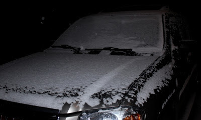
No biggee, just some light snow totally covering the driveway at 8pm, at 26 degrees.  Not a huge amount of showers left coming in from TN, but still enough to maybe make for slick conditions...just be careful.  Sorry for the low quality pics...too late and dark to do any better!  :-)  FYI, pics are from the end of Staymon Rd, ~3775'

good ol' light snow  8pm

Driveway solidly covered @ 8pm
 ----------------------------------------------------------------

Last night's advisory for sleet/ice was dropped this morning...I had no lower than 34 degrees this morning, and the view below at 8:20am was 'right pretty' as we say in the South. 

This morning's view (click to enlarge)
 Our next advisory is already posted for 3pm this afternoon through 6am Sunday, per the possibility of snow showers that could accumulate.  They're calling 1-3" near the TN border and mainly above 3500 feet...for ACA, once again my maps have us in the 0-1" range.  Best chances look to roll in just after dark for a couple of hours, and with the possibility of no break between the changeover from rain to snow, there may be some icing on the roads.  The low is forecast to be in the low 20s, so plenty of cold air coming in rather quickly behind today's front.

There is another chance for wintry weather late New Year's Eve into the morning hours, though that system looks like all the others in its minor impact potential.  Just a heads up for anyone on the road late that night.

Bob

Friday, December 28, 2012

Overnight weather...

I wasn't going to post anything, but ACA is now under a winter weather advisory through noon Saturday... NOT for snow but for sleet and light icing.  Not much is expected, but I always refer to ice as "The Great Equalizer" as the smallest amount will make any and all vehicles slip.  I should add the advisory is for elevations at and above 3500 feet, which in ACA is the Moskos family 'blue roof house'.  Temperatures below that line should be too warm to accumulate anything of consequence.

There may be yet another advisory posted Saturday for the evening and night for light snow, but it looks very limited, still running in the 0-1" category like the past few systems.  Next week's weather is unsettled for several days, with additional opportunities for some snow.  At this time, there is no big system to be concerned about, just small, quick hitting periods of potentially wintry weather.

We had quite an inversion in ACA last night.  At 3775 feet, I was 24 degrees at 10p, 28 degrees at 1am, and by sunrise I was  at 38 degrees.  Under certain conditions, cold air flows down into the lower elevations, forcing the relatively warmer air there up to the higher elevations.  Down low, it was 30-31 on Russ Avenue in Waynesville when I headed out on some errands around 9am.

Per rainfall, I picked up 0.84" Monday, and .72" Wednesday, along with a good skiff of snow .  Good bit more rain heading our way in the next week.

Bob

Tuesday, December 25, 2012

12/26 Weather Concerns

While this incoming system will wreak havoc on several levels in the Southeast Wednesday, for ACA it's another high wind even that is of concern. I don't see MPH numbers like we had recently, but between midnight tonight and early tomorrow morning gusts to 35 mph are possible, with gusts above 30 through Wednesday. 

Plenty of rain coming as well, though the heaviest amounts will be on the southeastern edge of the Blue Ridge (Highlands, Lake Toxaway, Brevard, etc.).  With saturated soils and trees weakened by our prior high wind event that brought down some trees here, conditions are ripe for more downed trees and power outages.

While we could have some thunderstorms Wednesday, well down into the Piedmont and Coastal Plain there could be tornadoes spawned.  'Tis a vigorous system that I hope spares us from any brunt to be had.

While there is a potential for lightly accumulating snow overnight Wednesday into Thursday, significant accumulations are not expected (maps listing 0-1" for ACA, maybe 2" on TN border).  With that said, I had a big issue with the last little white road covering so be aware of potential problems early Thursday morning.  Better chance for snow, albeit very light, will be Saturday evening into early Sunday morning when another cold front plows through.  I'll cross that bridge later.


Bob

Friday, December 21, 2012

ROAD conditions

11:22am UPDATE

I successfully sledded down some salt and got myself out and back home on Staymon.  Below is the 9:50am update, for information purposes. APPLE CREEK ROAD will be salted as soon as the salter can get to it, which should alleviate our problems later today.  Do read the comments below...Lynn Damon made it back up after turning around as there were vehicle issues.  I am crossing fingers that once the salt is laid down, Apple Creek becomes far more driveable by late this afternoon.  Thanks for everyone's calls and input.

9:50am UPDATE:

I headed out earlier to check out Apple Creek Road...from Staymon up I negotiated it rather easily with AWD, and a good bit of the surface up high has little snow on it until you get to Tanneyhill Lane.

HOWEVER...from the double hairpins down it is DANGEROUSLY SLICK.  Tire tracks are all over the road, into ditches, and that includes some of mine.  From the lowest hairpin down I lost traction going downhill like a snail in bulldog gear, and how I missed the Damon's mailbox I'll never know.  I got breached on Apple Creek, and as I slid slowly downhill I ended up pointing uphill.  I was able to crawl up a little bit and get two wheels off into the leaves, but could get no further.  I've walked home to sled down some salt and get to a safer area.

I talked with Chris Martin who had heard on the scanner that a car may have gone off Apple Creek Road but that the Sheriff deputy could not get up to it because of icy road.  I have  no verification of any of that, but it wouldn't surprise me.  And yet, I THINK Lynn Damon got up to her driveway in her Subaru wagon, so I can't call the road impossible...just very dangerous at the moment. May be that my 5,000 pound car is a detriment in this silky, icy snow.

I have heard no word about whether or when the road will be salted, but I'll pass it along here.  Please use comment form on this blog to post any reports you have.


Bob

Wednesday, December 19, 2012

Weather 'heads up'

A potent cold front will pass through ACA Thursday afternoon, with sharply colder air moving in behind it.  There will be minimal snow behind this system, Thursday night into Friday morning, so that's not my concern (models suggest 0 to 1" in ACA). The winds, however, will be some of the strongest we've seen in a while, with gusts at high elevations up to 60+ mph....we could see gusts in the 40-45 range, maybe higher for those few of you exposed at the top of ACA.  Items not nailed down outside may want to migrate, especially if you have larger holiday decorations outside.  Power outages are expected, so this is a good time to make sure you have flashlights and candles ready to go.

Friday is looking flat out uncomfortable if you have to be outdoors...winds will be steady in the 20-34 mph range, and shaded areas more than likely won't reach 32 degrees.  Temps will modify some over the weekend, but our unusual warmth of late will take a hike for a while.

FYI, Looks like rain chances ramp up Christmas Eve and hang around a couple of days with highs in the 40s and lows in the 30s.

bob

Tuesday, December 18, 2012

A Random Act of Kindness

I don't know Bill's last name...they are renting Karen's house just short of Staymon.  When you drive down Apple Creek Road, you'll notice it looks wider...that's because Bill spent a few hours yesterday shoveling the wet leaves that caked the outer edges of the road, making for slippery travel, especially when passing other cars.  Thank you, Bill, for your caring attitude and actions!

Super duper cold and wintry weather will continue to have trouble getting down into our region, so not seeing any travel issues anytime soon.  Suits me fine.  Recent rains totaled 1.12" in my gauge, fyi.

bob

Sunday, December 16, 2012

S(NO)w and neat links

Scrap that early chin-stroker for snow Monday night...light wrap-around border snow is at best all that will fall.  There will be a chance for some more light accumulation Thursday night into Friday, but too early to tell anything more.  We have been fortunate with the milder weather overall...I was thinking back 3 years ago where on December 18 we were getting our rather paralyzing 18" of snow here in ACA.  That'll teach you to keep the cupboards stocked....!

DEC 2010 on Staymon

Non-ACA links here, but ones you might be interested in.....

First is the National Weather Services graphic of % chances for a white Christmas:
CLICK HERE

Second is a well done, comparative site of before and after pictures from Hurricane Sandy's devastation in the Mid-Atlantic/NE.  You take your mouse and slide it left to right across the pictures and it reveals the sobering details of the destruction wrought forth.  I do not know if this will work on Apple devices, but give it a try:
CLICK HERE


bob

Wednesday, December 12, 2012

Some snow next week?

Happy 12-12-12, y'all.  Not been much to pass along per ACA news and happenings of late.  Good thing Chris and Helen are now back so they can open their door next week for those that can't get up the mountain....

OK, not anticipating Snowmageddon...but most models indicate a day of rain next Monday with a pretty cold backside that shows snow for our area Tuesday the 18th.  The fact that it arrives after we've been warm and rainy will help, but could also mean more ice issues if and when the changeover continues, and if we have enough rain to make our roadside seeps become active.  

Way too early to show up on my handy dandy snow graphics, so just throwing it out there for the moment...not written in stone that this is a 'given', either. 

December dawn (click to enlarge)

bob