Monday, December 31, 2012

Weather 'Improvement'....

LAST DAWN OF 2012! (click to enlarge)
 I love old jazz music...and one of the greats that left this planet far too early was Billie Holiday who made famous such songs as, "What a difference a day makes, 24 little hours....".  In the same vein, we could alter the words to "What a difference a degree makes..." with incoming weather starting tonight.

Once again another inversion last night...it was 24 degrees at 10pm and 38 degrees by 8am at my place.  Where there was concern for accumulating sleet/snow/freezing rain overnight tonight, that is all kaput with lows holding 33 at the coldest, even in the high country.  Not that you might not see/hear some sleet mix in, but for what precipitation is slated for the next few days should all be liquid.

There is a small chance for a wintry mix Wednesday night, but it looks very minor at this time.

Unless things change drastically, this will be my last post this year.  ;-)  Cheers to a prosperous and safe 2013 for us all.

bob

Sunday, December 30, 2012

SUNDAY AM update

I'll just start a new post for info pertaining to the roads this morning.  I have a good 1/2" of snow here at the end of Staymon, and all roads, surfaces are white...including around Junaluska.  When I swept a path on the deck, there was no ice underneath thanks to little to no liquid precipitation before the snow showers came; however, like last time, where you step or where the pups ran, those imprints would not sweep up.  I can only imagine the roads are a bit slick, for all the obvious reasons.

Dick Fields just wrote (750a) that just below the lower hairpin at his place "the snow was crunchy but not slippery. There were several sets of straight tire tracks on the road with no evidence of anyone losing traction."

If anyone has any road reports, or info on salting, etc., just comment here, or email me/call and I can add it in. My air temp is 17 and I'm not sure I'll hit 32 degrees today as I'm all shade.

Bob

Saturday, December 29, 2012

And Another Winter Weather Advisory...

8pm update:
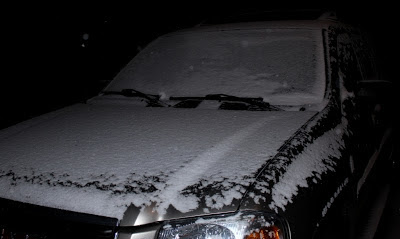
No biggee, just some light snow totally covering the driveway at 8pm, at 26 degrees.  Not a huge amount of showers left coming in from TN, but still enough to maybe make for slick conditions...just be careful.  Sorry for the low quality pics...too late and dark to do any better!  :-)  FYI, pics are from the end of Staymon Rd, ~3775'

good ol' light snow  8pm

Driveway solidly covered @ 8pm
 ----------------------------------------------------------------

Last night's advisory for sleet/ice was dropped this morning...I had no lower than 34 degrees this morning, and the view below at 8:20am was 'right pretty' as we say in the South. 

This morning's view (click to enlarge)
 Our next advisory is already posted for 3pm this afternoon through 6am Sunday, per the possibility of snow showers that could accumulate.  They're calling 1-3" near the TN border and mainly above 3500 feet...for ACA, once again my maps have us in the 0-1" range.  Best chances look to roll in just after dark for a couple of hours, and with the possibility of no break between the changeover from rain to snow, there may be some icing on the roads.  The low is forecast to be in the low 20s, so plenty of cold air coming in rather quickly behind today's front.

There is another chance for wintry weather late New Year's Eve into the morning hours, though that system looks like all the others in its minor impact potential.  Just a heads up for anyone on the road late that night.

Bob

Friday, December 28, 2012

Overnight weather...

I wasn't going to post anything, but ACA is now under a winter weather advisory through noon Saturday... NOT for snow but for sleet and light icing.  Not much is expected, but I always refer to ice as "The Great Equalizer" as the smallest amount will make any and all vehicles slip.  I should add the advisory is for elevations at and above 3500 feet, which in ACA is the Moskos family 'blue roof house'.  Temperatures below that line should be too warm to accumulate anything of consequence.

There may be yet another advisory posted Saturday for the evening and night for light snow, but it looks very limited, still running in the 0-1" category like the past few systems.  Next week's weather is unsettled for several days, with additional opportunities for some snow.  At this time, there is no big system to be concerned about, just small, quick hitting periods of potentially wintry weather.

We had quite an inversion in ACA last night.  At 3775 feet, I was 24 degrees at 10p, 28 degrees at 1am, and by sunrise I was  at 38 degrees.  Under certain conditions, cold air flows down into the lower elevations, forcing the relatively warmer air there up to the higher elevations.  Down low, it was 30-31 on Russ Avenue in Waynesville when I headed out on some errands around 9am.

Per rainfall, I picked up 0.84" Monday, and .72" Wednesday, along with a good skiff of snow .  Good bit more rain heading our way in the next week.

Bob

Tuesday, December 25, 2012

12/26 Weather Concerns

While this incoming system will wreak havoc on several levels in the Southeast Wednesday, for ACA it's another high wind even that is of concern. I don't see MPH numbers like we had recently, but between midnight tonight and early tomorrow morning gusts to 35 mph are possible, with gusts above 30 through Wednesday. 

Plenty of rain coming as well, though the heaviest amounts will be on the southeastern edge of the Blue Ridge (Highlands, Lake Toxaway, Brevard, etc.).  With saturated soils and trees weakened by our prior high wind event that brought down some trees here, conditions are ripe for more downed trees and power outages.

While we could have some thunderstorms Wednesday, well down into the Piedmont and Coastal Plain there could be tornadoes spawned.  'Tis a vigorous system that I hope spares us from any brunt to be had.

While there is a potential for lightly accumulating snow overnight Wednesday into Thursday, significant accumulations are not expected (maps listing 0-1" for ACA, maybe 2" on TN border).  With that said, I had a big issue with the last little white road covering so be aware of potential problems early Thursday morning.  Better chance for snow, albeit very light, will be Saturday evening into early Sunday morning when another cold front plows through.  I'll cross that bridge later.


Bob

Friday, December 21, 2012

ROAD conditions

11:22am UPDATE

I successfully sledded down some salt and got myself out and back home on Staymon.  Below is the 9:50am update, for information purposes. APPLE CREEK ROAD will be salted as soon as the salter can get to it, which should alleviate our problems later today.  Do read the comments below...Lynn Damon made it back up after turning around as there were vehicle issues.  I am crossing fingers that once the salt is laid down, Apple Creek becomes far more driveable by late this afternoon.  Thanks for everyone's calls and input.

9:50am UPDATE:

I headed out earlier to check out Apple Creek Road...from Staymon up I negotiated it rather easily with AWD, and a good bit of the surface up high has little snow on it until you get to Tanneyhill Lane.

HOWEVER...from the double hairpins down it is DANGEROUSLY SLICK.  Tire tracks are all over the road, into ditches, and that includes some of mine.  From the lowest hairpin down I lost traction going downhill like a snail in bulldog gear, and how I missed the Damon's mailbox I'll never know.  I got breached on Apple Creek, and as I slid slowly downhill I ended up pointing uphill.  I was able to crawl up a little bit and get two wheels off into the leaves, but could get no further.  I've walked home to sled down some salt and get to a safer area.

I talked with Chris Martin who had heard on the scanner that a car may have gone off Apple Creek Road but that the Sheriff deputy could not get up to it because of icy road.  I have  no verification of any of that, but it wouldn't surprise me.  And yet, I THINK Lynn Damon got up to her driveway in her Subaru wagon, so I can't call the road impossible...just very dangerous at the moment. May be that my 5,000 pound car is a detriment in this silky, icy snow.

I have heard no word about whether or when the road will be salted, but I'll pass it along here.  Please use comment form on this blog to post any reports you have.


Bob

Wednesday, December 19, 2012

Weather 'heads up'

A potent cold front will pass through ACA Thursday afternoon, with sharply colder air moving in behind it.  There will be minimal snow behind this system, Thursday night into Friday morning, so that's not my concern (models suggest 0 to 1" in ACA). The winds, however, will be some of the strongest we've seen in a while, with gusts at high elevations up to 60+ mph....we could see gusts in the 40-45 range, maybe higher for those few of you exposed at the top of ACA.  Items not nailed down outside may want to migrate, especially if you have larger holiday decorations outside.  Power outages are expected, so this is a good time to make sure you have flashlights and candles ready to go.

Friday is looking flat out uncomfortable if you have to be outdoors...winds will be steady in the 20-34 mph range, and shaded areas more than likely won't reach 32 degrees.  Temps will modify some over the weekend, but our unusual warmth of late will take a hike for a while.

FYI, Looks like rain chances ramp up Christmas Eve and hang around a couple of days with highs in the 40s and lows in the 30s.

bob

Tuesday, December 18, 2012

A Random Act of Kindness

I don't know Bill's last name...they are renting Karen's house just short of Staymon.  When you drive down Apple Creek Road, you'll notice it looks wider...that's because Bill spent a few hours yesterday shoveling the wet leaves that caked the outer edges of the road, making for slippery travel, especially when passing other cars.  Thank you, Bill, for your caring attitude and actions!

Super duper cold and wintry weather will continue to have trouble getting down into our region, so not seeing any travel issues anytime soon.  Suits me fine.  Recent rains totaled 1.12" in my gauge, fyi.

bob

Sunday, December 16, 2012

S(NO)w and neat links

Scrap that early chin-stroker for snow Monday night...light wrap-around border snow is at best all that will fall.  There will be a chance for some more light accumulation Thursday night into Friday, but too early to tell anything more.  We have been fortunate with the milder weather overall...I was thinking back 3 years ago where on December 18 we were getting our rather paralyzing 18" of snow here in ACA.  That'll teach you to keep the cupboards stocked....!

DEC 2010 on Staymon

Non-ACA links here, but ones you might be interested in.....

First is the National Weather Services graphic of % chances for a white Christmas:
CLICK HERE

Second is a well done, comparative site of before and after pictures from Hurricane Sandy's devastation in the Mid-Atlantic/NE.  You take your mouse and slide it left to right across the pictures and it reveals the sobering details of the destruction wrought forth.  I do not know if this will work on Apple devices, but give it a try:
CLICK HERE


bob

Wednesday, December 12, 2012

Some snow next week?

Happy 12-12-12, y'all.  Not been much to pass along per ACA news and happenings of late.  Good thing Chris and Helen are now back so they can open their door next week for those that can't get up the mountain....

OK, not anticipating Snowmageddon...but most models indicate a day of rain next Monday with a pretty cold backside that shows snow for our area Tuesday the 18th.  The fact that it arrives after we've been warm and rainy will help, but could also mean more ice issues if and when the changeover continues, and if we have enough rain to make our roadside seeps become active.  

Way too early to show up on my handy dandy snow graphics, so just throwing it out there for the moment...not written in stone that this is a 'given', either. 

December dawn (click to enlarge)

bob

Tuesday, November 6, 2012

Weather update

     I'm in the salt mines in Charlotte as I type, but Al Rose said he already has 1/2" of snow and his temp is 32.5 degrees.  I usually don't post if it looks like less than an inch of snow, but this system got off to an early start and the overnight runs of the NAM and GFS upped our ACA in a 1-3" band (which would correlate more to our elevation with lighter stuff at the bottom and the bigger amounts up top where Al is).  

     HOWEVER, it is supposed to mix with rain soon and stay above freezing, which would limit those #s.  I suppose those amounts will work if the temps hold low a few hours more, but afternoon temps are forecast to be well above freezing.  Would not anticipate any road issues.

UPDATE 7:30a - Got an Apple Creek Road update that had 32 degrees at the top with 1" of wet snow, and coating the road, slushy not icy.  At the red house 'flat' for sale, 32 degrees, but accumulations stop on the road, just on vegetation.  At the entrance, 32 degrees but snow mixing with rain and no accumulation.  At Junaluska it was 36 degrees. 

Bob


Thursday, November 1, 2012

Wow - updated NC snow reports

Got in to work this morning and ran across this finalized snow report from the GSP weather office put out last night.  We were very lucky not to be any closer to the TN border in this storm.  Note the Newfound Gap report and the Haywood reports and drifts. The NAM got it right, overall for this storm, but we were fortunate to be just out of the heavier snow bands.  WHEW!!!!!

********************STORM TOTAL SNOWFALL********************

LOCATION          STORM TOTAL     TIME/DATE   COMMENTS
                     SNOWFALL           OF
                     /INCHES/   MEASUREMENT

NORTH CAROLINA

...AVERY COUNTY...
   ELK PARK              14.0   142 PM 10/30  COUNTY OFFICIAL
   2 ENE LINVILLE        12.7  1000 AM 10/31  COCORAHS
   E FLAT SPRINGS        10.2   700 PM 10/31  1E. 1.36 LIQ EQV
   BEECH MOUNTAIN         7.5   730 AM 10/30  CO-OP OBSERVER
   NEWLAND                7.0   800 AM 10/30  PUBLIC
   BANNER ELK             4.0   800 AM 10/30  CO-OP OBSERVER
   1 SW LINVILLE FALLS    1.2   600 AM 10/31  COCORAHS

...BUNCOMBE COUNTY...
   4 NNE ASHEVILLE        5.0   700 AM 10/31  COCORAHS
   WEAVERVILLE            5.0  1200 PM 10/30  2720 ELEVATION.
   1 NNE BARNARDSVILLE    4.0  1100 AM 10/30  PUBLIC
   FAIRVIEW               2.0   300 PM 10/30  3200FT. MIX FZ RAIN.
   3 NNW SWANNANOA        0.8   700 AM 10/30  COCORAHS
   1 NE MONTREAT          0.2   800 AM 10/30  COCORAHS
   5 SW CANDLER           0.1   700 AM 10/30  COCORAHS

...GRAHAM COUNTY...
   10 W ROBBINSVILLE      1.0   816 PM 10/28  5200 FT

...HAYWOOD COUNTY...
   10 NW COVE CREEK      24.0  1100 AM 10/30  PARK SERVICE
   8 SW SPRING CREEK     18.0  1100 AM 10/31  4000FT. 5 TO 6FT DRIFTS
   10 N CLYDE             9.1   900 AM 10/30  COCORAHS
   4 E WAYNESVILLE        2.0   800 AM 10/30  COCORAHS
   5 N LAKE JUNALUSKA     1.5   700 AM 10/30  COCORAHS
   8 SSE CANTON           1.4   900 AM 10/31  COCORAHS
   3 ENE MAGGIE VALLEY    1.3   700 AM 10/30  COCORAHS

...JACKSON COUNTY...
   4 ESE WHITTIER         3.5   700 AM 10/31  COCORAHS
   4 E TUCKASEGEE         1.0   800 AM 10/31  COCORAHS
   CULLOWHEE                T   730 AM 10/30  PUBLIC

...MADISON COUNTY...
   FAUST                 24.0  1100 AM 10/30  EMERGENCY MNGR
   5 WNW HOT SPRINGS     14.0  1208 PM 10/31  SPOTTER AT TN BORDER.
   5 NNE MARS HILL        8.9   630 AM 10/31  COCORAHS
   MARSHALL               3.0   700 AM 10/30  TOTAL PRECIP 0.96.

...MITCHELL COUNTY...
   5 N BAKERSVILLE       14.9   730 AM 10/31  COCORAHS
   BULADEAN              12.0  1100 AM 10/30  SPOTTER. STILL SNOWING.

...SWAIN COUNTY...
   NEWFOUND GAP          36.0   700 AM 10/31  NWS MRX REPORT
   BRYSON CITY              T  1256 PM 10/30  LOCAL POLICE

...TRANSYLVANIA COUNTY...
   3 ESE CRUSO            5.0  1223 PM 10/30  PUBLIC

...YANCEY COUNTY...
   7 SSW BURNSVILLE       6.0   800 AM 10/31  COCORAHS
   1 NW BALD CREEK        4.7   800 AM 10/31  COCORAHS
   MOUNT MITCHELL STATE   2.8   700 AM 10/30  MIN TEMP 18. 
 
------------------ 
Bob 

Wednesday, October 31, 2012

Storm data update

Just passing along some reports from the National Weather Service. The TN/NC border did get hammered, but rapid 
fall-off in accumulations.  Enjoy the  warm up ahead! 
(kinda sorta...)  Blogger is being recalcitrant this morning, and I can't get the words/fonts to behave.  C'est la guerre at times with this site!


NORTH CAROLINA

...AVERY COUNTY...
   ELK PARK              14.0   142 PM 10/30  COUNTY OFFICIAL
   FLAT SPRINGS           9.8   700 PM 10/30  1 INCH PAST 6 HOURS

...BUNCOMBE COUNTY...
   WEAVERVILLE            5.0  1200 PM 10/30  2720 FEET ELEVATION.
   4 NE ASHEVILLE         3.0   700 PM 10/30  TOWN MTN RD AT PARKWAY.
   FAIRVIEW               2.0   300 PM 10/30  3200 FT ELE. SOME -FZRA
...HAYWOOD COUNTY...     24.0    (PULLED FROM EARLIER REPORT)
   COVE CREEK
...MADISON COUNTY...
   3 NNW FAUST           13.0   100 AM 10/31  SAMS GAP. 8-13 INCHES

...MITCHELL COUNTY...
   BAKERSVILLE            5.5   100 PM 10/30  PUBLIC

...SWAIN COUNTY...
   NEWFOUND GAP          22.0  1230 PM 10/30  NWS OFFICE
   BRYSON CITY              T  1256 PM 10/30  LOCAL POLICE

...TRANSYLVANIA COUNTY...
   3 ESE CRUSO            5.0  1223 PM 10/30  PUBLIC

Tuesday, October 30, 2012

WHEW....

Up to 36 degrees, so should not be any road issues, if there were any to begin with.  Snow staying NE.  Smokies DID get 18" of snow, but heavy totals limited to thin band on the TN/NC line.  Only up to 3-4" in neighboring areas.  And we kept our power on the whole time, probably the most amazing aspect of our little wintry hit. For my youngest rescue pup @10 months old, this was her first measurable snow and she is happy as a clam,  Heck, the way it's all turned out, I'M happy as a clam!  Now that I've said that, why is it we refer to clams as happy?  Hmmmm.....


Maisy before her first snow....

bob

Tuesday AM update

So far so good, all things considered.  Still moisture upstream to head this way as blowing snow, but looks like the GFS won ACA's first round of wintry weather with it's low-side prediction.  Moskos family reported no snow/ice at the blue roof house, but I've got something close to 2" here at the end of Staymon.  My driveway has a lot of the snow blown off, but there is a VERY slick icy layer under the thinnish white veil, along with icy leaves.  Al Rose reported the road is clear to the top, and they were at 29 degrees.

9a update:  looks like any appreciable snowfall still to come will stay just NE of us.  at 7am there were several places with 3-4" of snow, but no more than that...still holds
11:20am update:  Well, I'll be...the Smokies did get whammied!  18" at Newfound Gap, 17" at Mt. LeConte


9am view NE toward Junaluska

745 AM Tuesday

My big maple just a week ago!

Amazed that the power has stayed on (knock on wood)...and the core of colder air simply hasn't gotten here, either.  I was at 31 all night, no mid 20s.


Feel free to add any info in the comment section or email me and I'll put it in.  I'll also add some photos in to this post shortly, as well as data updates that y'all might find interesting.  Watching news reports what has happened in the NE...eeeegads.

bob

Monday, October 29, 2012

Monday AM UPDATE and VOTING

Up on Staymon the temp had been sitting at 32 degrees for a long time, with almost 1/2" of snow.  The heaviest snowfall will occur this evening and through sunrise Tuesday, with lessening chances thereafter... Sandy has now made the left hook and heading to the Jersey Shore for a landfall after midnight.

The GFS run from early this morning hasn't come down yet, but last night it had ACA in a 2-5" range.  The NAM still has ACA in a very tightly banded 4-10" range within a distance of only 4-5 miles, with 18"+ at places like Max Patch, Mount Sterling, etc.

I'm actually heading out shortly as I need to go to the early voting site since I won't be here Tuesday.  If you'd like to vote early, a location is quite close by. Turn right at the end of Mauney Cove Road and as you get close to the crest of the hill, you can't miss it on the right (Senior Resource Center), thanks to the boatload of political signs.  It's open this week 830a to 5p, unless weather gets bad down low.  You can also vote early at the Canton Public Library.

Bob

Sunday, October 28, 2012

Sunday 4pm UPDATE

(6p update with graphics, in blue)

This is the third post per wintry weather thanks to Hurricane Sandy's path.  Check the other two posts for background info.  Significant changes per timing and precipitation to follow.

First, and no surprise, the National Weather Service has posted several warnings for us here in ACA.  You can read about the details HERE.  All warnings in effect from midnight tonight through 6am Wednesday.   It's unusual, serious stuff that impacts us over days:


Winter Storm Warning
Freeze Warning
High Wind Warning

The NAM 12Z run printed several hours later, hence my later posting of these graphics. Of course, the winds will be whipping the snow all around, making actual accumulations very hard to nail down.  But I'm putting the 12Z runs (8am EDT) in below.  The GFS still keeps us only in a roughly 2" window, but the NAM has us in a 6-12" band, tightly gradated.  FYI, it takes a good 5 hours or more for a run to become graphically manipulated, hence the delay:

(CLICK PICS TO ENLARGE)
12Z GFS Sunday AM
12Z NAM Sunday AM
CHANGES:  The magic 32 degree temp has been upped to get here shortly after midnight. I've been 40 most of the day, now at 36 at 6pm.  Precip now goes to almost all snow at that point, and a much smaller window of any rain mixing in Monday noon-ish, early afternoon. Personally, I'm comfortable with the NWS storm total of 5-8" scenario, but deep down, if you want to call me on it, I do think more than that is pretty likely.

Below is the latest path and timing update of Sandy...still holding to a hard north hook up into Canada, but this storm is expansive.  I feel the GFS has underdone this winter storm for us, and the NAM has been a little too hot and heavy. As Sandy's remnants start moving north, our weather calms down and improves. The answer is in the middle, so hunker down.  I made my grocery run earlier so my pups won't mutiny on me!  

SANDY 2p Sunday run
Bob

Sunday AM Snow Update

First, this is a follow up post to yesterday's entry, if you want to pick up more background info.

Long story short, the GFS may be missing something (though I would love for it to be spot on!), and the NAM is seeing something else entirely...there is no doubt that where the circulation of Sandy travels once inland, will make a mountain of difference in any snow here in ACA.  When you enlarge the NAM graphic, if it were to verify, it would equal our 18" that dumped a week before Christmas in 2009 (I think?)...I remember it clearly as one of these graphic data sets showed 16-18" one day before it hit.  I was in Lowe's picking up some things, the clerk asked about the snow chances as they were calling for 4-8", and I quipped I saw one model put down over a foot for us...and, voila.  I got stuck at the end of Staymon for 6 days, and it was largely the impetus of my starting this blog.

I will also say that as long as I've analyzed snow forecasts for western NC, I have not seen such a large difference in amounts between these two models.  GFS still holds a 1", maybe 2" for us, and the NAM has 16"-20" VERY close by:
(click on pics to enlarge)
2AM Sunday GFS

2AM Sunday NAM

Light rain is possible overnight tonight...and that magical 32 degree temp should be here around 7a Monday, when any precip should be snow.  There is a possibility that rain will mix back in mid day Monday, but by supper time Monday another favored model has us in 'definite' or 'likely' snow categories through Tuesday.  Stands to reason that will potentially be our real travel trouble time. More than likely I'll update later this afternoon...it really is all about Sandy at this point.

Bob

Saturday, October 27, 2012

A Little White With Our Fall Color?...

All good ponies have to go back to the barn at some point...we've trail-ridden some spoiling weather of late, and it's coming to a crashing halt. While Sunday will be a much cooler day, the big changes start coming in Sunday night into a Monday morning well below freezing...and we may well not see 40 degrees until Thursday.  Add to that some strong winds that will blow at or above 20 mph most of the time between Sunday evening and Tuesday night, and you've got some very uncomfortable conditions, not withstanding the chance for trees to come down and power outages.  Just a friendly heads up for that...

Now, that ol' "S" word.  There is no doubt the West Virginia Highlands will bring home the bacon with a forecast in the 2' to 4' range (yep, FEET)...possibly more in places with just the right exposure and orientation.  Just how far down the Appalachian spine does the snow fall is the big question.  The whole event will be an upslope flow from the NW out of TN, and with stiff winds any accumulations get knocked around.  Ah, but what about here around ACA?   Boone's chances for accumulating snow are much higher as they are closer to the action...but "Sandy" is an expansive tropical system, and the precipitation will wheel around at great distances.

Every year I repeat the following info, for those new to here or this blog:
----------------

To save you from going back to old blog entries, and for the newer readers, I wanted to pass along how I keep abreast of potential winter weather. I've been a broadcast meteorologist for over 20 years, and still fill in at my former station in Charlotte on a regular basis. To listen to WLOS or the radio or read a generic website will often give very incomplete, non-specific information, if not misleading and/or incorrect.  When I post here, it is specific to Apple Creek Acres, our general N/NE exposure, and attention to our elevations which start at ~2880' at the entrance to ~3900' at the top.

The Moskos family lives in what most of us refer to as the 'blue roof' house, and that's important because they are pretty much at 3500'....ask anyone here, a LOT often happens at that elevation per winter weather problems.  You'll see me talk of issues above or below that location often. I rely a lot on a particular pair of forecast models that have 'runs' x4 per day...both have biases, so it is interesting to watch as to which best handles the event.  There is the NAM (North American Mesoscale) and the GFS (Global Forecast System).  I get and post here some of those graphics as they relate to a developing situation.
---------------
At this time, and I've been watching the runs since Friday when I was at work, and it will be interesting to see which one 'wins' or is more accurate.  The GFS has only a dusting for ACA, 1" or less...while the NAM on the low side has had us 2"-4", and one run 4" to 6".  Clearly the two are far, far apart in how to handle this system.


The trickier part is that this is not our normal snow scenario...an upslope flow is normal, but not to this length and with this much wind.  Even if the NAM were to be correct and we got a decent accumulation, you can't consider plowing, etc. until it's all done, which will be a drawn out process.  The precipitation may be mixed with rain early on Sunday evening, so just be prepared for travel/road issues, which I hope we don't have to put up with just yet.

Looking at the latest forecast path for "Sandy's" circulation, I want to hedge with the GFS.  I think snow will fly, but I don't anticipate driving issues for us.  Currently the path is to come ashore along the southern Jersey Shore late Monday night, head inland and then north to the eastern Great Lakes and into Canada...earlier models had that low heading to Ohio and slowing down, which would send more precip this way...and maybe what the NAM was seeing.

As always, I'll post updates as the time approaches...otherwise, you'd better believe I'm doing all the sanding and carport work I can today and tomorrow!

Bob


Thursday, October 18, 2012

Some bear news, non-ACA...

I'm sitting here in Charlotte getting ready to go into work, and have police and news helicopters and scads of emergency vehicles on-scene one subdivision over..a construction/trench rescue, I think.  Anyhow, in searching for the breaking news, I ran across an article that is worthy of FYI.  For many reasons, bears in our region are on the move and having more encounters with two-leggeds.

For the first time in at least five years, camping has been closed in the Shining Rock Wilderness area and Graveyard Fields, two very popular destinations just off the Blue Ridge Parkway.  There have been seven recent bear encounters with campers in those areas, the latest just last Monday when a tent and food bag were torn up.  No one was injured, thankfully, though you can imagine the two people inside the tent have quite a story to tell.  Those areas are open for daytime use, but overnight camping has been suspended until further notice.

Looking forward to getting back to ACA in a few days...crazy work schedule of late.  I did phone in the elk report to the wildlife officers at the Smokies...seems like lots of critters have on their travelin' shoes these days.  :-)

Bob

Saturday, September 29, 2012

Fall is 'bearing' down on us...

Just got a nice phone call from Irene...I've been out of town a good bit and missed this morning's event in the 'too much fun!' department.  I'd heard Keith Patton had been wanting to get a pup for a while, which explains why he now has one.  Around 9am his new pup came running from the pond between his house and Irene's there in the relative 'flat' of Apple Creek Road.  Tail between his legs and the whole nine disturbed yards he came at full tilt.  

Keith walked up from his abode toward the pond....only to realize why the pup bolted. Keith stared at the digging bear.  The bear then stopped and stared at Keith.  Keith calmly turned around and walked back down, and the bear continued his digging for what they guessed was a big ol' beehive in  a stump or hole in the ground.  Consider it Winnie the Pooh on steroids.


We continue to have regular bear sightings, and many of us muse if it is more than one bear finding our mountainside fruitful.  Backing up the bus, Chris Martin had sent in some good pics of the bruin at his place after it helped itself to suet cakes.  So when Chris and Helen took off on a trip, I couldn't help but send him the picture below to let him know "the word has gotten out!"  

PARTY AT CHRIS'S PAD!!!  (click to enlarge)   


Bob


Saturday, September 22, 2012

Bears still active

Just this morning, two ACA homes were raided by a bear (or bears, but guessing it's just one).  Of course, we know they're around, and while we'd like to think they are moving on, they clearly have learned where and how to get some grub, and probably won't do what we 'think' they will, not at this time.

Bear  at the Rose house this AM
The Rose's take their feeders in at night, and put them out in the morning...alas, this morning, the bear Al Rose got a picture of visited around 9am and had a little feast.  But later today, I got an email from Dick Fields that they, too, had their feeders ransacked this morning, though the perpetrator was not actually seen.

Yeah, yeah, yeah, bears come through here from time to time and we all know the routine.  Just wanted to put this information out there that you may want to be watchful yet, maybe take your feeders in or do what you can to minimize attracting our furry four legged ursines.

As I told Dick Fields, if it'll make you feel better, I'm happy to loan you one of my 3 pups for guard dog duty...the only problem is they may well take liberties chewing up something near and dear to you!  :-)

Happy Fall, y'all!  Officially came in this morning just before 11am EDT.  Feel the excitement....

Bob

Thursday, September 13, 2012

A few updates...

I've been out of town more than I've been on the mountain the past few weeks, so I've been out of the loop a little bit.  Heavens but this drier cooler air feels wonderful up here!  Been a Turkish steam bath in Charlotte until last Sunday...and might I say what an experience it was to be working at my station which sits in Uptown Charlotte, with the Democratic National Convention going on.  Fascinating on many levels, with security out the wazoo.

I'll start with an open note to the new board that if there is news/info pertinent to homeowners here to please let me know so I can post it.  The board has already had its first meeting and elected the following officers:

Lorraine Conard, President
Linda Hughes, Vice-President
Frank Moskos, Treasurer
Terri Rose, Secretary
(Jan Woodlief resigned from the board)

Been a busy late-summer with bears here, with numerous reports/sightings in ACA.  Al Rose sent me this short snippet of a deck visitor that was searching for a tasty bird feeder a week ago.  Hopefully the ripening acorn crop will have them move on to other feeding areas.

 
Bob

Sunday, August 19, 2012

Onward and upward....

Dawn from a couple of weeks ago - click to enlarge
 The annual meeting of the Apple Creek Homeowners Association was held this past Thursday, August 16. 29 homeowners were present, holding a total of 91 proxies...might well be a record, at least in recent times. The meeting officially began around 6:45p and adjourned a clean 3 hours later at 9:45p.  To say the discussions and dialogue were 'spirited' would be putting it mildly, but anticipated.

By the close of the meeting, a new board had been elected: Jan Woodlief, Frank Moskos, Lorraine Conard, Terry Rose, and Linda Hughes. 

Many concerns among some of the ACA home owners boil down knowing and interpreting our by-laws and covenants.  At the end of the meeting Norman Jacobs made a generous offer to any takers; on his own time and nickel, he made copies of these documents and had them in folders, free for the taking.  I would urge any of you that do not have copies to contact him and pick 'em up, and also to read over them.  As with most things in life, knowledge is power.

Too, throwing this out there...I hope each board member gets a copy and familiarizes themselves with these documents as we move forward.  It can only help.  :)

Bob

Tuesday, August 14, 2012

NEW SIGN....

Okay, so there really isn't a new sign...but one could argue putting one up at Chris Martin's house at the lower end of Apple Creek Road:

BEAR CROSSING

For the second time in just a few weeks, an adult black bear has found some things in that area pallatable, like a suet feeder Chris had 7 feet off the ground just this morning.  This from Chris (click on pics to enlarge):
-----------------------------

Dear Apple Creek,

Not my bear #1 is back.  After pawing down a 7 foot high hanging pad of suet he ( he for convenience, might call him shorty) strolled casually off behind the left  side of the garage to eat.  Sorry I missed the shot of him standing to reach the suet.      Has anyone else sited this critter.  Would like to figure out his route.  I'm beginning to suspect he's coming down from the Batchelor's via the 

This is a very adult bear not carved of wood and very sneaky.     I suspect  Suet is just the thing bears are looking for this time of year.  A wad of fat!  So heads up you guys and the Conner bees too.  It's  time to hide the beer, wine, and cheese.  Don't want this bear addicted to the stuff we eat.  It'll kill ya.  

By the way, the Conner bees eat at my place too via the hummingbird feeders. Is this a good or bad thing for bees?   They can put away a lot of juice in a day.      


 Just another fantastic day in the the Apple Creek Hood.  

Our best to all,

Chris and Helen


------------------------------------------

Bob

Tuesday, August 7, 2012

Anybody lose a hound?

I'm guessing this is the dog that has been seen in the upper part of ACA the past couple of days.  I went ahead and picked her up last night, and have begun the process of checking with vets and lost and found boards.  Later today I'll take her by a vet to see if she has been chipped.  If you're looking to adopt a great pup, I can tell you she has yet to utter a bark and is very sweet and loving...and submissive as she slid in immediately with my brood of 3 females.  (click on pics to enlarge)


Guessing she's about 2 years old, ~40 lbs., seems very healthy, with super short darkly brindled hair and a 5" bobbed tail.  Big ol' white blaze from under the chin down through her chest, and has feet/toes as if they were dipped in white paint.

Holler at me if you know where she belongs or if you'd like to see her....she really has a sweet disposition, but three is all I can handle.

Bob  704-996-3184

Tuesday, July 31, 2012

ANNUAL MEETING and stuff

The heavens opened up early this morning here in ACA...I tallied 1.92" in my gauge by the time all was said and done here at the end of Staymon at 3775'. Wish I could figure out a way to make a fortune off of my fruitful Mosquito Farm that continues to propagate in ridiculous fashion...

By now, ye ACA homeowners should have received a letter/announcement for the annual meeting, including an all-important proxy.  Please read all the enclosed information carefully and respond accordingly, if you cannot attend in person.

DATE:  Thursday, August 16, 2012
TIME:  6:30pm til ?
WHERE:  100 South Main Street
Waynesville 1st Baptist Church
Waynesville, NC
(this is where we've me the past two years)

Here is a map picture of the location (click to enlarge):


Here is a view of the place taken from Google maps (click to enlarge):


bob

Tuesday, July 10, 2012

WHAT'S 'BRUIN' IN ACA....

Look, we all know bears are part of our vernacular here in the mountains, and they do come through from time to time....apparently one adult heard that Chris Martin makes one mean Mojito and came a-callin' during 'Happy Hour' a couple of days ago....Helen snapped this pic of Chris's new fan.


Appears to be a nice adult black bear, and I 'm sure it continued on it's merry way.  If you have outdoor pets and bird feeders, as most of us do, just know to be extra watchful this time of the year.  Notwithstanding, the coyotes will soon be back around, which are, for me, of far more concern.

bob

Tuesday, July 3, 2012

Storm info, updates...

Quite the coverage of overnight storms we had Sunday into early Monday.  Not sure when the power went out, but it was back on after a few hours.  While I've posted this info before (archived), I recommend putting the outage line phone number into your cell phone, or keeping it handy if your land line is still working after an outage.  Yes, the Duke Power/Progress-Energy merger has gone through, but for now all will continue to work as it has, in terms of phone numbers, websites, etc.  The automated 'report outage' number is:

1.800.419.6356

They also have an interactive outage map online you can access at:

HERE or  https://www.progress-energy.com/app/outagemaps/carolinas.aspx

That site may not work with Apple products, fyi...the ol' flash player thing.  I picked up 1.14" of rain from the storms, though it may have been heavier on top of the mountain.

----------------------------------

Humble thanks to IRENE and JUDY for their continued care and upkeep of our ACA entrance area.  On their own time and nickel they keep the mulch and foliage freshened, along with seasonal touches.  It is greatly appreciated - take a moment to thank them when you cross paths!

----------------------------------

Glad the heat has taken a break...highest I got was 93 in the shade, which is rather unheard of at the higher elevation here.  Pic (clickable) was from the sultry sunrise last Friday where places like Columbia, SC set their all-time record high of 109 degrees.


------------------------------------------------ 

Our Annual meeting is coming up not too long from now...as soon as I get any confirmed information about it I will pass it along.  If you have any questions before then, contact the ACHOA president Jan Woodlief.

bob