By Wednesday afternoon, highs are forecast to get just above freezing, but round #1 of precipitation moves in, and will most likely be snow that afternoon. MY CONCERN: we've had bitterly cold temps, so ground and roads are quite cold. What falls will stick and stay, unlike Sunday. Roads could deteriorate rather quickly with a good snow burst. Overnight, it will be occasional snow, but possibly mix with freezing rain by Thursday morning. I see an inch or two for this push of wintry precipitation.
Thursday's high is supposed to go well above freezing, 40s, with freezing rain switching over to rain. Thursday night will be rain-snow mix, and right now the forecast low is around 33-35 degrees, holding almost steady through the day Friday with anticipated rain. Friday night through noon Saturday, it goes back to all snow, and most likely the best chance for inches of snow.
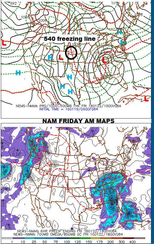
IF the low would travel just 100 miles farther east, this would be all snow and a huge mess. As it is, the low looks like it will travel right along the Blue Ridge, bringing a good amount of rain Thursday and Friday. These maps show the NAM and GFS in agreement about the path of the low over the mountains.

Any accumulations of snow/ice from round #1 should dismantle by Thursday early afternoon. At this time, both the NAM and the GFS are putting down 2-3" of snow, but I know for a fact the NAM can't see Friday night yet. This posting isn't for amounts just yet, just a big ol' "heads up" for potential road issues just ahead. I'll cover more amount details later.
Bob
No comments:
Post a Comment