WINTRY MIX NUISANCE AHEAD
This incoming system has little going for it in the accumulation department. Models are pretty much running 0.5-2" of snow, sleet, and freezing rain. But you'll never really know how much we get as rain and such will beat back accumulations. While there may be periods and patches of slippery roads around ACA, I'm expecting to be able to get around in 4WD.
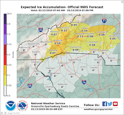
The slipperiness of ice will be the big concern, but Haywood County may well miss out on that as the warmer temps push back in from the SW. This NWS graphic shows us breathing a sigh of relief as we don't need more travel woes and possible power outages.
 |
| (CLICK TO ENLARGE) |
Saturday will be the colder of the days, and may start as all snow in bursts, with the sleet and freezing rain mixing in as the day and night wears on. By Sunday, any precipitation switches over to all rain as the day progresses, ending our concerns.
I'll update if necessary early Saturday morning.
Bob

No comments:
Post a Comment